Band-e Amir National Park
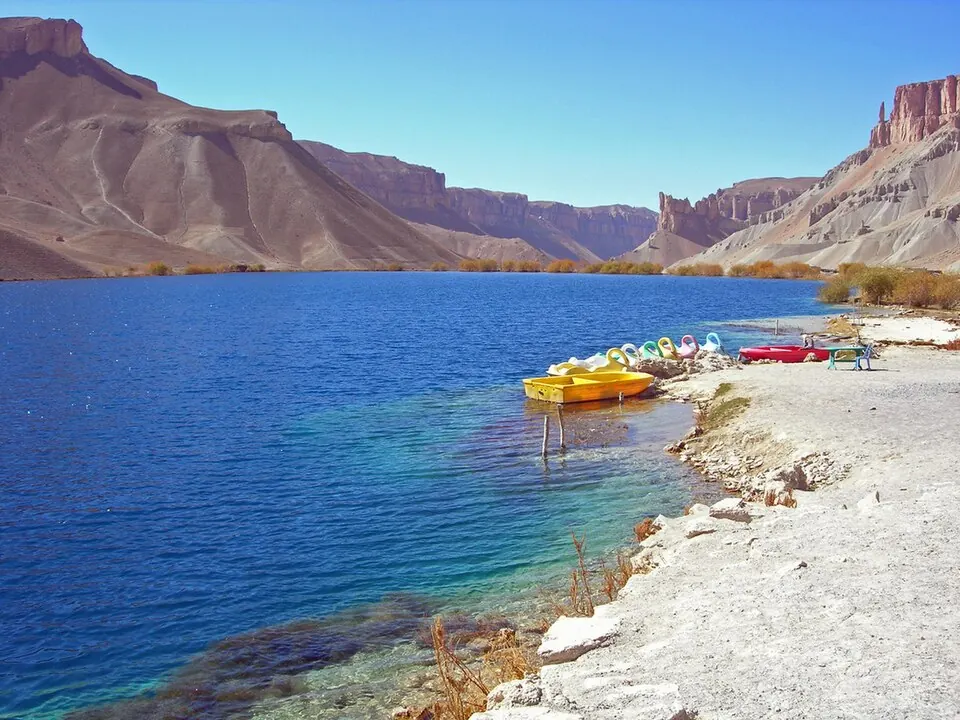
Band-e Amir National Park is a national park in the Bamyan Province of Afghanistan. It is a Tentative World Heritage Site and part of the list of World Heritage Sites in Northern and Central Asia. It is one of the 13 sights listed for the country on this site and is the 8th most looked-up sight in Afghanistan on English Wikipedia.
Planning a visit
The weather is warmest from June to August, with daily highs reaching 20 °C. These months also have the least rainfall, with July and August seeing about 7 to 11 mm of rain. From November to March, temperatures are below freezing, with January being the coldest month with lows of -18 °C.
Kabul International Airport is the nearest airport, located 184 km away. The park is 180 km from the capital, Kabul. The park covers an area of 590 km² at an elevation of 2,909 m.
Weather by month
The warmest month is July, with an average high of 20 °C. The wettest is March, with about 95 mm of rain.
| Jan | Feb | Mar | Apr | May | Jun | Jul | Aug | Sep | Oct | Nov | Dec | |
|---|---|---|---|---|---|---|---|---|---|---|---|---|
| Average high, °C | -9 | -8 | -3 | 4 | 12 | 17 | 20 | 20 | 16 | 10 | 3 | -5 |
| Average low, °C | -18 | -16 | -11 | -5 | 0 | 4 | 6 | 5 | 2 | -2 | -8 | -15 |
| Rainfall, mm | 61 | 83 | 95 | 55 | 54 | 23 | 11 | 7 | 7 | 18 | 30 | 52 |
| Rainy days | 7 | 7 | 9 | 8 | 6 | 3 | 4 | 3 | 2 | 3 | 6 | 4 |
Temperatures and rainfall: 1981–2010 averages for this spot (4 km grid), from CHELSA. Rainy days: 2015–2024, NASA POWER.