Aconcagua
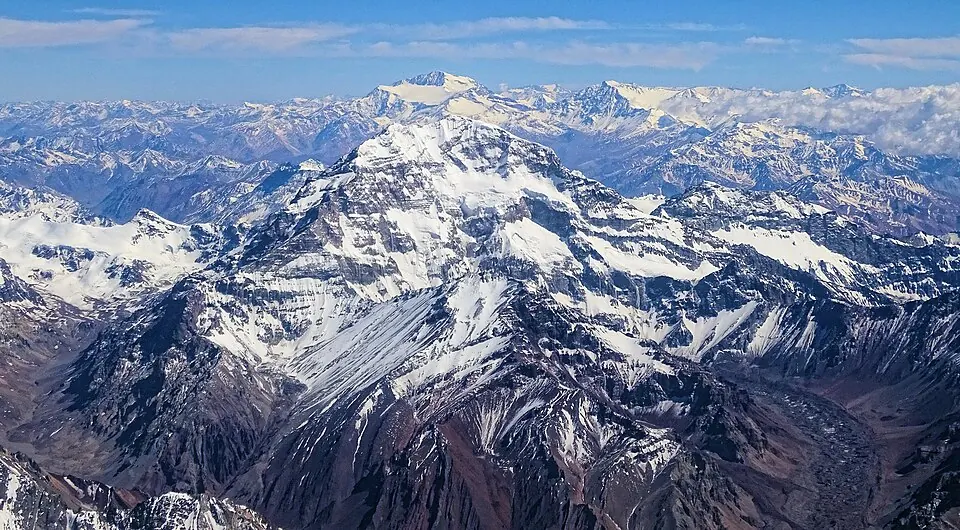
Aconcagua is a mountain located in Las Heras Department, Argentina, and is part of the Seven Summits and the Principal Cordillera. It is made of sedimentary rock and andesite, and reaches an elevation of 6962 m. It is one of the most looked-up sights in Argentina.
Planning a visit
The warmest months are January and February, with daily highs of -3 °C and lows of -13 °C, along with 32 mm to 36 mm of rain. The coldest months are June and July, with daily highs dropping to -22 °C and -23 °C and lows of -27 °C and -28 °C, accompanied by heavy rain or snow reaching 281 mm and 275 mm.
The nearest airport is Comodoro Arturo Merino Benítez International Airport in Santiago, Chile, located 109 km away. Aconcagua is 1098 km from Buenos Aires.
Weather by month
The warmest month is February, with an average high of -3 °C. The wettest is June, with about 281 mm of rain.
| Jan | Feb | Mar | Apr | May | Jun | Jul | Aug | Sep | Oct | Nov | Dec | |
|---|---|---|---|---|---|---|---|---|---|---|---|---|
| Average high, °C | -3 | -3 | -4 | -11 | -18 | -22 | -23 | -21 | -20 | -17 | -13 | -7 |
| Average low, °C | -13 | -13 | -15 | -20 | -25 | -27 | -28 | -27 | -27 | -25 | -22 | -17 |
| Rainfall, mm | 32 | 36 | 42 | 57 | 167 | 281 | 275 | 197 | 73 | 31 | 31 | 32 |
| Rainy days | 6 | 4 | 3 | 2 | 3 | 4 | 3 | 3 | 2 | 2 | 2 | 3 |
Temperatures and rainfall: 1981–2010 averages for this spot (4 km grid), from CHELSA. Rainy days: 2015–2024, NASA POWER.