Angkor ក្រុងអង្គរ
Cambodia UNESCO World Heritage Site

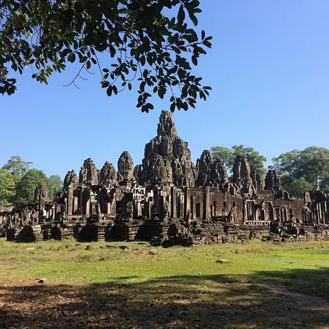
Angkor is an ancient city and archaeological site located in Siem Reap Province, Cambodia. Spanning 351 square kilometers, this UNESCO World Heritage Site is one of the most looked-up sights in the country.
Planning a visit
The driest months are December and January, with daily highs around 30 °C to 31 °C and minimal rainfall. Temperatures remain high throughout the year, peaking at 34 °C in March and April. The rainy season begins in May and lasts through October, with September experiencing the most precipitation at 305 mm over about 25 days. Visitors can reach the site via Siem Reap-Angkor International Airport, which is located 43 km away. The capital, Phnom Penh, is 239 km from the site.
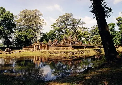
Several significant locations are situated near Angkor, including Bayon at 2.9 km, Angkor Wat at 4.3 km, and Ta Prohm at 6.0 km. Banteay Srei is also accessible at a distance of 23.1 km.
Weather by month
The warmest month is April, with an average high of 34 °C. The wettest is September, with about 305 mm of rain.
| Jan | Feb | Mar | Apr | May | Jun | Jul | Aug | Sep | Oct | Nov | Dec | |
|---|---|---|---|---|---|---|---|---|---|---|---|---|
| Average high, °C | 31 | 33 | 34 | 34 | 33 | 32 | 32 | 31 | 31 | 30 | 30 | 30 |
| Average low, °C | 21 | 23 | 25 | 26 | 26 | 26 | 25 | 25 | 24 | 24 | 22 | 21 |
| Rainfall, mm | 4 | 7 | 30 | 64 | 161 | 218 | 205 | 209 | 305 | 201 | 61 | 8 |
| Rainy days | 3 | 3 | 8 | 11 | 20 | 22 | 26 | 25 | 25 | 18 | 9 | 2 |
Temperatures and rainfall: 1981–2010 averages for this spot (4 km grid), from CHELSA. Rainy days: 2015–2024, NASA POWER.