Algonquin Provincial Park
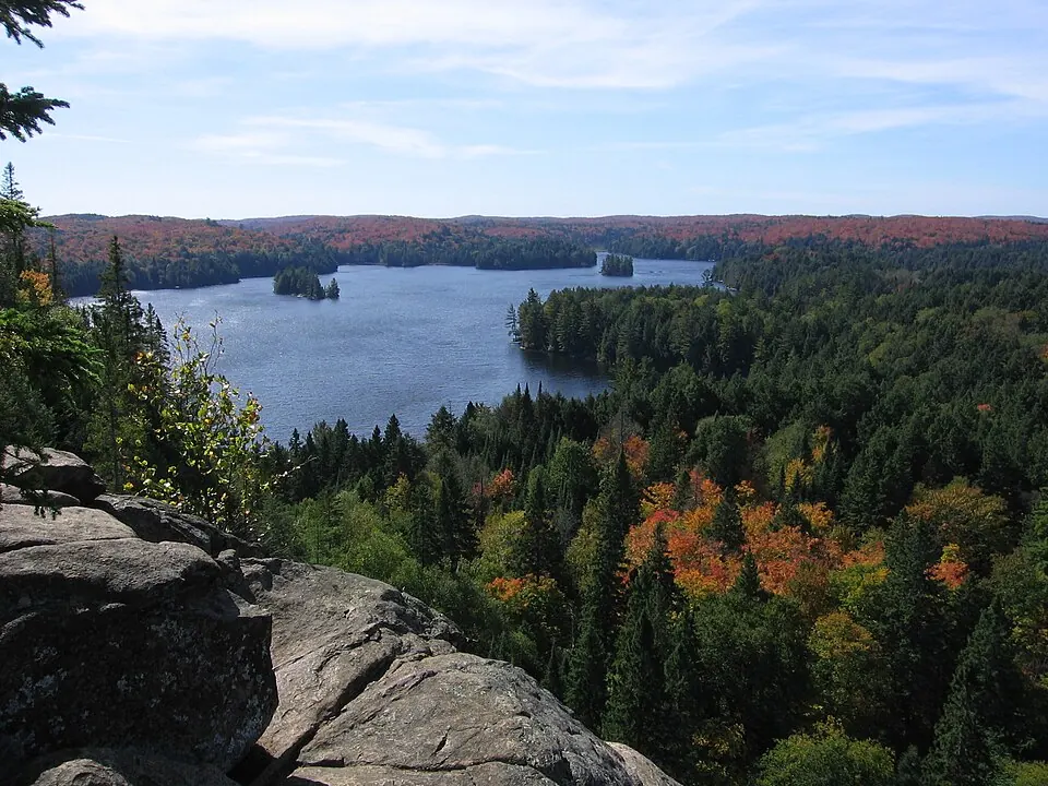
Algonquin Provincial Park is a provincial park in Ontario and a national historic site of Canada. It covers an area of about 7,723 km² and is named after the Algonquin people.
Planning a visit
The weather varies by season, with the warmest months being July and August, when daily highs reach about 23 °C and 22 °C. The coldest period is in January, with daily highs of -7 °C and lows of -15 °C. Rainfall is highest in September, with about 102 mm of rain.
Visitors can reach the park via North Bay Jack Garland Airport, which is 84 km away, or through Ottawa Macdonald-Cartier International Airport, located 242 km from the park. The site is 237 km from the capital, Ottawa. It is one of the 93 sights of Canada featured on this site and is ranked 48th in popularity among the country's sights based on English Wikipedia lookups.
Weather by month
The warmest month is July, with an average high of 23 °C. Rain is spread fairly evenly through the year.
| Jan | Feb | Mar | Apr | May | Jun | Jul | Aug | Sep | Oct | Nov | Dec | |
|---|---|---|---|---|---|---|---|---|---|---|---|---|
| Average high, °C | -7 | -5 | 1 | 9 | 16 | 21 | 23 | 22 | 18 | 11 | 4 | -3 |
| Average low, °C | -15 | -13 | -8 | -1 | 6 | 12 | 15 | 15 | 11 | 4 | -2 | -10 |
| Rainfall, mm | 71 | 63 | 64 | 68 | 84 | 86 | 90 | 84 | 102 | 94 | 92 | 81 |
| Rainy days | 8 | 10 | 9 | 12 | 13 | 15 | 16 | 15 | 12 | 14 | 11 | 10 |
Temperatures and rainfall: 1981–2010 averages for this spot (4 km grid), from CHELSA. Rainy days: 2015–2024, NASA POWER.