Chuquicamata
Calama, Chile
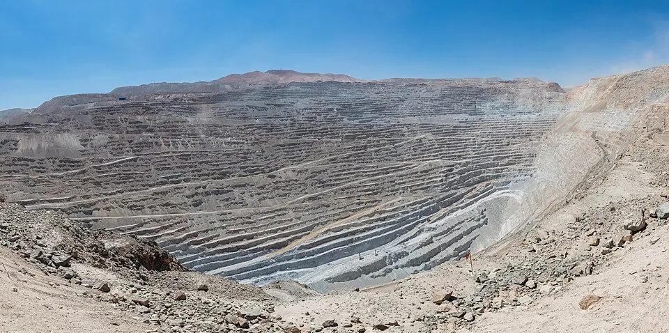
Chuquicamata is a mine in the Calama area of Chile. It is one of the 14 sights of Chile listed on this site and is the 7th most looked-up sight in the country on English Wikipedia.
Planning a visit
The climate is dry with very little rain throughout the year. Temperatures are warmest from October to March, when daily highs reach about 20 °C. The coolest months are June and July, when daily lows reach 0 °C.
To reach the site, you can fly into El Loa Airport in Calama, which is 23 km away. The Andrés Sabella Gálvez International Airport in Antofagasta is 204 km away. Chuquicamata is located 1,251 km from the capital, Santiago.
Weather by month
The warmest month is November, with an average high of 20 °C. Rain is spread fairly evenly through the year.
| Jan | Feb | Mar | Apr | May | Jun | Jul | Aug | Sep | Oct | Nov | Dec | |
|---|---|---|---|---|---|---|---|---|---|---|---|---|
| Average high, °C | 20 | 20 | 20 | 19 | 17 | 16 | 16 | 18 | 18 | 20 | 20 | 20 |
| Average low, °C | 7 | 7 | 7 | 5 | 2 | 0 | 0 | 1 | 2 | 4 | 5 | 7 |
| Rainfall, mm | 8 | 12 | 6 | 2 | 3 | 3 | 2 | 1 | 1 | 0 | 0 | 2 |
| Rainy days | 0 | 0 | 1 | 0 | 0 | 0 | 0 | 0 | 0 | 0 | 0 | 1 |
Temperatures and rainfall: 1981–2010 averages for this spot (4 km grid), from CHELSA. Rainy days: 2015–2024, NASA POWER.