Torres del Paine National Park Parque Nacional Torres del Paine
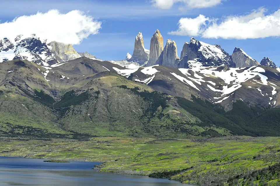
Torres del Paine National Park is a national park located in Torres del Paine, Última Esperanza Province, Chile. Established in 1959, the park covers an area of 1814 square kilometers at an elevation of 579 meters. It is one of the most looked-up sights in Chile on English Wikipedia.
Planning a visit
The park experiences daily highs and lows throughout the year. In January, the average daily high is 4 °C and the low is -3 °C, with about 253 mm of rain across 27 days. July is the coldest month, featuring a high of -4 °C and a low of -9 °C, with 256 mm of rain on about 23 days. April records the highest rainfall at 333 mm over 24 days, with a high of 0 °C and a low of -4 °C.
The nearest airport is Lieutenant Julio Gallardo Airport in Puerto Natales, located 82 km away, while Piloto Civil Norberto Fernández International Airport in Rio Gallegos is 264 km away. The park is situated 1960 km from Santiago.
Weather by month
The warmest month is February, with an average high of 4 °C. Rain is spread fairly evenly through the year.
| Jan | Feb | Mar | Apr | May | Jun | Jul | Aug | Sep | Oct | Nov | Dec | |
|---|---|---|---|---|---|---|---|---|---|---|---|---|
| Average high, °C | 4 | 4 | 3 | 0 | -2 | -4 | -4 | -4 | -2 | -1 | 0 | 2 |
| Average low, °C | -3 | -2 | -3 | -4 | -6 | -8 | -9 | -8 | -8 | -7 | -6 | -4 |
| Rainfall, mm | 253 | 221 | 297 | 333 | 281 | 261 | 256 | 230 | 195 | 244 | 202 | 270 |
| Rainy days | 27 | 23 | 26 | 24 | 22 | 24 | 23 | 24 | 23 | 26 | 25 | 27 |
Temperatures and rainfall: 1981–2010 averages for this spot (4 km grid), from CHELSA. Rainy days: 2015–2024, NASA POWER.