Djibouti
Country · Africa, Eastern Africa
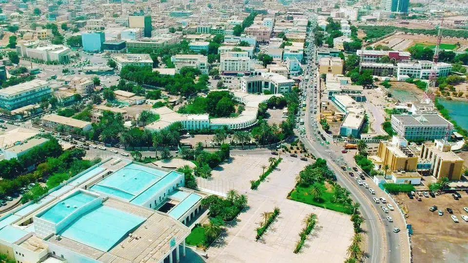
Djibouti is a country in Eastern Africa, bordered by Eritrea, Ethiopia, and Somalia by land or sea. Its capital is Djibouti. Covering an area of 23,200 square kilometers, it has a population of about 1.2 million.
Highlights
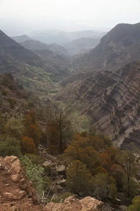
The site covers 1 top sight. Among these is Day Forest National Park.
When to go
The climate at the capital, Djibouti, shows daily highs and lows throughout the year. In January, temperatures range from a high of 26 °C to a low of 23 °C with 23 mm of rain on about 2 days. February sees a high of 27 °C and a low of 23 °C with 16 mm of rain on about 3 days. March brings a high of 28 °C, a low of 25 °C, and 34 mm of rain on about 5 days. April has a high of 30 °C, a low of 26 °C, and 49 mm of rain on about 10 days. May warms to a high of 33 °C and a low of 28 °C with 13 mm of rain on about 6 days. June reaches a high of 36 °C and a low of 31 °C with 1 mm of rain on about 2 days. July is the hottest month, with a high of 38 °C and a low of 31 °C, alongside 5 mm of rain on about 4 days. August has a high of 37 °C and a low of 30 °C with 14 mm of rain on about 4 days. September records a high of 34 °C and a low of 30 °C with 8 mm of rain on about 4 days. October brings a high of 31 °C and a low of 27 °C with 27 mm of rain on about 5 days. November cools to a high of 28 °C and a low of 25 °C with 12 mm of rain on about 4 days. December records a high of 27 °C and a low of 24 °C with 28 mm of rain on about 4 days.
Practical notes
The currency is the Djiboutian franc. Official languages are French and Arabic. Driving is on the right side of the road. The time zone is UTC+03:00. Power plugs are of type C and E, operating at a voltage of 220.0 V.
Top sights in Djibouti
Weather by month
The warmest month is July, with an average high of 38 °C. Rain is spread fairly evenly through the year.
| Jan | Feb | Mar | Apr | May | Jun | Jul | Aug | Sep | Oct | Nov | Dec | |
|---|---|---|---|---|---|---|---|---|---|---|---|---|
| Average high, °C | 26 | 27 | 28 | 30 | 33 | 36 | 38 | 37 | 35 | 31 | 28 | 27 |
| Average low, °C | 23 | 23 | 25 | 26 | 28 | 31 | 31 | 31 | 30 | 27 | 25 | 24 |
| Rainfall, mm | 23 | 16 | 34 | 49 | 13 | 1 | 5 | 14 | 8 | 27 | 12 | 28 |
| Rainy days | 2 | 3 | 5 | 10 | 6 | 2 | 4 | 5 | 4 | 5 | 4 | 4 |
Temperatures and rainfall: 1981–2010 averages for Djibouti (4 km grid), from CHELSA. Rainy days: 2015–2024, NASA POWER.