Agra
City in India

Agra is a city in India with a population of about 1.6 million. Located 178 kilometers from New Delhi, it is primarily visited for its significant historical landmarks, including multiple UNESCO World Heritage sites.
What to see
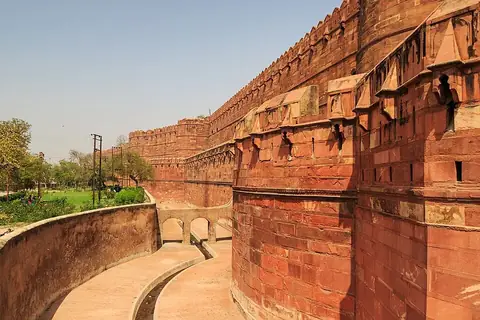
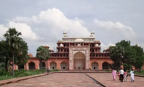
The city is defined by its major historical monuments. The most prominent are the Taj Mahal and the Agra Fort, both of which are UNESCO World Heritage sites. Visitors also travel to see the historic structure of Akbar's tomb. Additionally, the tomb of Itmad Ud Daulah is available for viewing.
When to go
The cooler months from November to February are generally the most comfortable for visiting, with daily highs ranging from 21 °C to 28 °C and minimal rainfall. Temperatures rise significantly beginning in March, peaking at 40 °C in May. The monsoon season arrives in June and lasts through September, bringing heavy rainfall, particularly in July and August when precipitation exceeds 200 mm.
Getting there
The nearest airport is Agra Airport, located 6 kilometers from the city. For international or larger domestic connections, Noida International Airport is 118 kilometers away.
Top sights in Agra

Weather by month
The warmest month is May, with an average high of 40 °C. The wettest is August, with about 205 mm of rain.
| Jan | Feb | Mar | Apr | May | Jun | Jul | Aug | Sep | Oct | Nov | Dec | |
|---|---|---|---|---|---|---|---|---|---|---|---|---|
| Average high, °C | 21 | 24 | 31 | 37 | 40 | 39 | 34 | 32 | 33 | 32 | 28 | 23 |
| Average low, °C | 8 | 11 | 15 | 21 | 26 | 28 | 27 | 26 | 24 | 20 | 14 | 9 |
| Rainfall, mm | 12 | 11 | 9 | 7 | 19 | 76 | 202 | 205 | 142 | 24 | 6 | 5 |
| Rainy days | 4 | 1 | 3 | 2 | 5 | 10 | 22 | 20 | 14 | 3 | 1 | 1 |
Temperatures and rainfall: 1981–2010 averages for Agra (4 km grid), from CHELSA. Rainy days: 2015–2024, NASA POWER.
Also worth a look
- Itmad Ud Daulah