Nicobar Islands
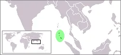
The Nicobar Islands are an island group and ecoregion in the Andaman and Nicobar Islands. They are one of 120 sights in India listed on this site and are ranked as the 69th most looked-up sight in the country on English Wikipedia.
Planning a visit
Average temperatures in the islands range from 26 °C to 28 °C. February is the driest month, with 51 mm of rain and 10 rainy days. Other months with relatively low rainfall include March, with 66 mm, and October, with 287 mm. The highest rainfall occurs in May, September, and November, which see about 306 mm of rain and about 28 rainy days.
The islands cover an area of 1841 km² and have an elevation of 642 m. They are located 2870 km from New Delhi. The nearest airport is Sultan Iskandar Muda International Airport in Banda Aceh, Indonesia, which is 336 km away from the islands.
Weather by month
Temperatures stay much the same all year, around 27 °C on average. The wettest is November, with about 326 mm of rain.
| Jan | Feb | Mar | Apr | May | Jun | Jul | Aug | Sep | Oct | Nov | Dec | |
|---|---|---|---|---|---|---|---|---|---|---|---|---|
| Average temperature, °C | 27 | 27 | 27 | 28 | 28 | 28 | 27 | 27 | 27 | 27 | 27 | 27 |
| Rainfall, mm | 90 | 51 | 66 | 115 | 306 | 259 | 249 | 232 | 306 | 287 | 326 | 214 |
| Rainy days | 17 | 10 | 11 | 18 | 27 | 26 | 27 | 26 | 28 | 29 | 26 | 22 |
Temperatures and rainfall: 1981–2010 averages for this spot (4 km grid), from CHELSA. Rainy days: 2015–2024, NASA POWER.