Kiribati
Country · Oceania, Micronesia
Kiribati is a country in Oceania located in Micronesia. The capital is South Tarawa, and the country has an area of 811 square kilometers with a population of about 136,000 in 2025. It offers visitors natural sights and marine environments across its atolls.
Highlights
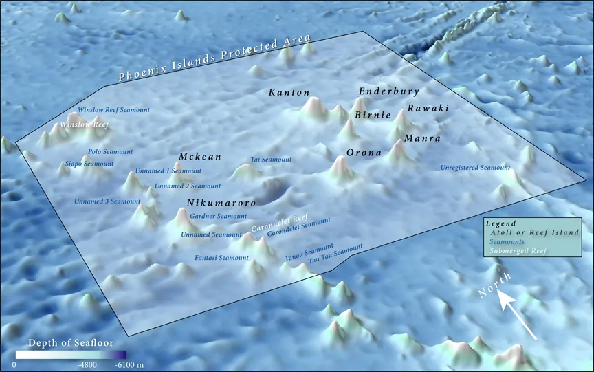
The site covers 1 top sight. The main highlight is the Phoenix Islands Protected Area, which is a UNESCO site.
When to go
Climate data at the capital, South Tarawa, shows average temperatures of 27 °C throughout the year. Rain varies by month, with lower rainfall totals occurring from September through November, which see about 125 mm to 154 mm of rain on about 12 rainy days each month. December and January experience higher rainfall, reaching up to 223 mm and 213 mm respectively.
Practical notes
The currencies used are the Kiribati dollar and the Australian dollar. Official languages are English and Gilbertese. Driving is on the left side of the road. Electrical plugs are type I with a voltage of 240.0 V. Time zones include UTC+12:00, UTC+13:00, and UTC+14:00.
Top sights in Kiribati
Weather by month
Temperatures stay much the same all year, around 27 °C on average. Rain is spread fairly evenly through the year.
| Jan | Feb | Mar | Apr | May | Jun | Jul | Aug | Sep | Oct | Nov | Dec | |
|---|---|---|---|---|---|---|---|---|---|---|---|---|
| Average temperature, °C | 27 | 27 | 27 | 27 | 27 | 27 | 27 | 27 | 27 | 27 | 27 | 27 |
| Rainfall, mm | 213 | 169 | 191 | 195 | 172 | 160 | 149 | 151 | 125 | 154 | 135 | 223 |
| Rainy days | 18 | 17 | 18 | 19 | 17 | 20 | 22 | 14 | 12 | 12 | 12 | 16 |
Temperatures and rainfall: 1981–2010 averages for South Tarawa (4 km grid), from CHELSA. Rainy days: 2015–2024, NASA POWER.