Cabo Pulmo National Park
Mexico UNESCO World Heritage Site
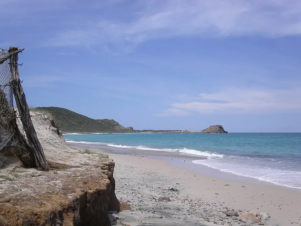
Cabo Pulmo National Park is a national park in Baja California Sur, Mexico, covering an area of 71 km2. It is a UNESCO World Heritage Site and a Ramsar site. It is one of the 55 most looked-up sights in Mexico on English Wikipedia and is one of the 66 sights of the country listed on this website.
Planning a visit
The climate varies throughout the year. The warmest months are July and August, when daily highs reach 33 °C. September is the wettest month, with 140 mm of rain and 12 rainy days. The driest months are April and May, which have 0 mm of rain. In January, daily highs are 23 °C and lows are 17 °C, while in December, highs are 24 °C and lows are 18 °C.
The nearest airport is Los Cabos International Airport in San José del Cabo, located 46 km away. The park is 1,156 km from Mexico City. It is part of the Islands and Protected Areas of the Gulf of California.
Weather by month
The warmest month is July, with an average high of 33 °C. The wettest is September, with about 140 mm of rain.
| Jan | Feb | Mar | Apr | May | Jun | Jul | Aug | Sep | Oct | Nov | Dec | |
|---|---|---|---|---|---|---|---|---|---|---|---|---|
| Average high, °C | 23 | 24 | 26 | 28 | 30 | 32 | 33 | 33 | 31 | 30 | 27 | 24 |
| Average low, °C | 17 | 17 | 18 | 20 | 22 | 25 | 27 | 27 | 26 | 25 | 21 | 18 |
| Rainfall, mm | 22 | 6 | 2 | 1 | 0 | 0 | 26 | 68 | 140 | 49 | 25 | 14 |
| Rainy days | 1 | 1 | 1 | 0 | 1 | 2 | 5 | 13 | 12 | 5 | 2 | 1 |
Temperatures and rainfall: 1981–2010 averages for this spot (4 km grid), from CHELSA. Rainy days: 2015–2024, NASA POWER.