Colorado River
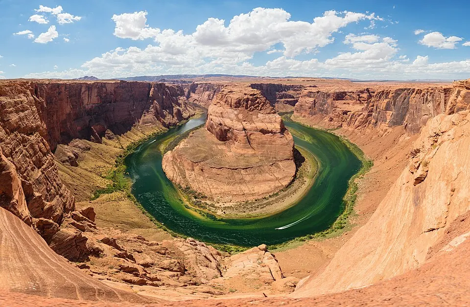
The Colorado River is a 2,334-kilometer river located in Mexico. It is one of the most looked-up sights in the country, ranking 3rd among the 55 sights listed on this site. The river crosses the administrative regions of Colorado, Utah, Arizona, and Nevada.
Planning a visit
Temperatures near the Colorado River vary significantly throughout the year. During the winter months of December, January, and February, daily high temperatures range from -7 °C to -5 °C, with lows dropping to -17 °C. Visitors seeking warmer conditions may prefer the summer months of June, July, and August, when daily highs reach between 15 °C and 19 °C. Precipitation is consistent across the year, with rainy days occurring in every month. May is the wettest month, with 84 mm of rain over about 15 days, while September experiences the fewest rainy days at approximately 7.
To reach the river, travelers can fly into the Rocky Mountain Metropolitan Airport (BJC) in Denver, United States, which is 87 km away. Alternatively, Denver International Airport (DEN) serves as a major hub 119 km from the site. The river is located 2,433 km from Mexico City. No specific opening hours, entry prices, or wheelchair access information is available for the river.
Weather by month
The warmest month is July, with an average high of 19 °C. Rain is spread fairly evenly through the year.
| Jan | Feb | Mar | Apr | May | Jun | Jul | Aug | Sep | Oct | Nov | Dec | |
|---|---|---|---|---|---|---|---|---|---|---|---|---|
| Average high, °C | -6 | -5 | -2 | 2 | 7 | 15 | 19 | 18 | 13 | 6 | -2 | -7 |
| Average low, °C | -16 | -16 | -13 | -9 | -5 | 1 | 5 | 4 | 0 | -6 | -13 | -17 |
| Rainfall, mm | 40 | 42 | 66 | 82 | 84 | 71 | 87 | 87 | 67 | 55 | 48 | 45 |
| Rainy days | 11 | 14 | 14 | 13 | 15 | 10 | 13 | 11 | 7 | 8 | 10 | 11 |
Temperatures and rainfall: 1981–2010 averages for this spot (4 km grid), from CHELSA. Rainy days: 2015–2024, NASA POWER.