Burkhan Khaldun
Mongolia UNESCO World Heritage Site
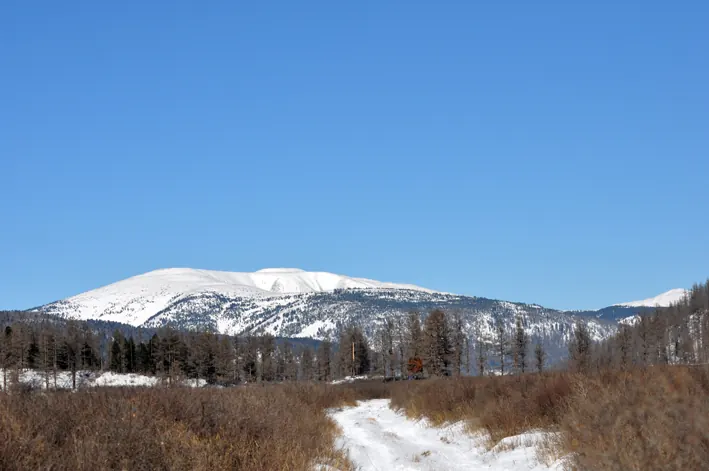
Burkhan Khaldun is a mountain and cultural landscape in Mongolia and a World Heritage Site situated in the Khentii Mountains. Covering an area of 4437 square kilometers with an elevation of 2450 meters, it is one of the sights of the country on this site and ranks first by English Wikipedia lookups among the country's sights.
Planning a visit
July is the warmest month with daily highs of 16 °C and lows of 7 °C, alongside 250 mm of rain on about 18 days. January is the coldest month with daily highs of -18 °C and lows of -28 °C, and 6 mm of rain on about 0 days.
The nearest airport is Ulaanbaatar Chinggis Khaan International Airport in Ulaanbaatar (Sergelen), Mongolia, located 215 km away. The site is 193 km from the capital, Ulaanbaatar.
Weather by month
The warmest month is July, with an average high of 16 °C. The wettest is July, with about 250 mm of rain.
| Jan | Feb | Mar | Apr | May | Jun | Jul | Aug | Sep | Oct | Nov | Dec | |
|---|---|---|---|---|---|---|---|---|---|---|---|---|
| Average high, °C | -18 | -14 | -8 | 0 | 9 | 14 | 16 | 15 | 8 | -1 | -10 | -16 |
| Average low, °C | -28 | -26 | -21 | -12 | -3 | 3 | 7 | 5 | -2 | -11 | -21 | -26 |
| Rainfall, mm | 6 | 7 | 12 | 32 | 59 | 162 | 250 | 217 | 91 | 31 | 13 | 10 |
| Rainy days | 0 | 1 | 3 | 5 | 9 | 15 | 18 | 17 | 12 | 5 | 3 | 1 |
Temperatures and rainfall: 1981–2010 averages for this spot (4 km grid), from CHELSA. Rainy days: 2015–2024, NASA POWER.