Nærøyfjord
Flåm, Norway UNESCO World Heritage Site
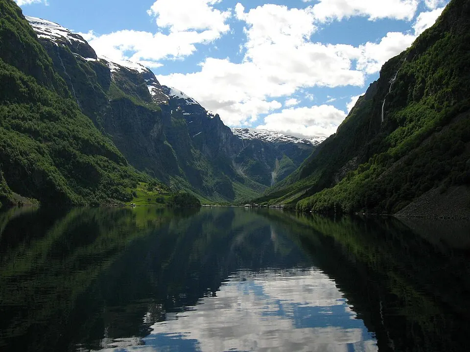
Nærøyfjord is a fjord located in the Aurland Municipality of Norway. It is part of the West Norwegian Fjords – Geirangerfjord and Nærøyfjord UNESCO World Heritage Site. It is the 28th most looked-up sight in Norway on English Wikipedia.
Planning a visit
July is the warmest month, with daily highs of 18 °C and lows of 11 °C. The coldest high temperatures are -3 °C, which occur in December, January, and February. May is the driest month with 68 mm of rain, whereas October is the wettest month with 188 mm. Other rainy months include January with 186 mm, September with 170 mm, and December with 160 mm. In August, daily highs reach 17 °C and lows are 10 °C, with 130 mm of rain, and in June, daily highs reach 16 °C and lows are 8 °C, with 84 mm of rain.
The fjord is located 238 km from Oslo. The nearest airport is Sogndal Airport, Haukåsen, which is 26 km away, and Bergen Airport, Flesland is 118 km away. Nearby attractions include the Flåm Line, which is 13.4 km away, Urnes Stave Church, 44.7 km away, and Borgund Stave Church, 48.9 km away.
Weather by month
The warmest month is July, with an average high of 18 °C. Rain is spread fairly evenly through the year.
| Jan | Feb | Mar | Apr | May | Jun | Jul | Aug | Sep | Oct | Nov | Dec | |
|---|---|---|---|---|---|---|---|---|---|---|---|---|
| Average high, °C | -3 | -3 | 0 | 4 | 9 | 16 | 18 | 17 | 12 | 5 | -1 | -3 |
| Average low, °C | -7 | -7 | -4 | -1 | 3 | 8 | 11 | 10 | 6 | 0 | -6 | -8 |
| Rainfall, mm | 186 | 134 | 118 | 72 | 68 | 84 | 102 | 130 | 170 | 188 | 162 | 160 |
| Rainy days | 22 | 21 | 20 | 15 | 17 | 18 | 22 | 21 | 19 | 20 | 18 | 22 |
Temperatures and rainfall: 1981–2010 averages for this spot (4 km grid), from CHELSA. Rainy days: 2015–2024, NASA POWER.