Sulu Archipelago Lupa’ Sūg
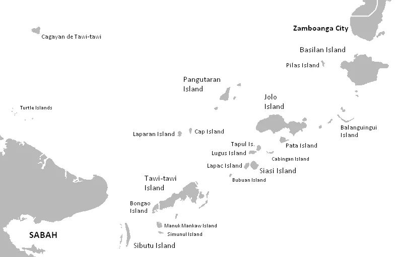
The Sulu Archipelago, known natively as Lupa’ Sūg, is an archipelago that forms part of the Mindanao region in the Philippines. It covers a total area of about 4,068 km2 and has an elevation of 114 m. It is one of the most looked-up sights in the country on English Wikipedia, currently ranking 18th among the country's sights.
Planning a visit
Temperatures remain steady throughout the year, with averages between 26 °C and 27 °C. The months of February, March, and April offer the least amount of rainfall, with monthly totals between 57 mm and 64 mm. Other months are notably wetter; for example, June sees about 144 mm of rain, and October is the rainiest month with approximately 174 mm of rainfall over 24 days. Rainfall in months like July and August also reaches over 130 mm.
To reach the archipelago, Jolo Airport is 6 km away, while Zamboanga International Airport is 156 km away. The islands are located 956 km from the capital city, Manila.
Weather by month
Temperatures stay much the same all year, around 26 °C on average. The wettest is October, with about 174 mm of rain.
| Jan | Feb | Mar | Apr | May | Jun | Jul | Aug | Sep | Oct | Nov | Dec | |
|---|---|---|---|---|---|---|---|---|---|---|---|---|
| Average temperature, °C | 26 | 26 | 26 | 26 | 27 | 26 | 26 | 26 | 26 | 26 | 26 | 26 |
| Rainfall, mm | 102 | 64 | 57 | 60 | 109 | 144 | 151 | 131 | 128 | 174 | 149 | 106 |
| Rainy days | 22 | 14 | 16 | 16 | 22 | 27 | 26 | 25 | 25 | 24 | 23 | 24 |
Temperatures and rainfall: 1981–2010 averages for this spot (4 km grid), from CHELSA. Rainy days: 2015–2024, NASA POWER.