Cederberg
South Africa UNESCO World Heritage Site
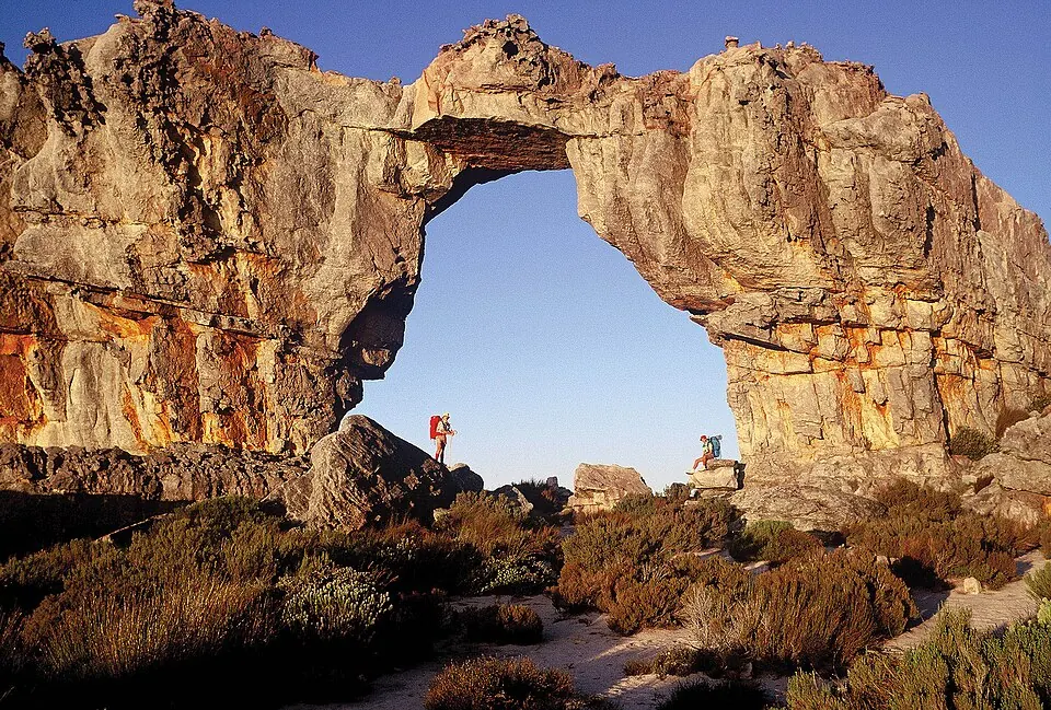
Cederberg is a mountain range and protected area in the Western Cape of South Africa, named after Widdringtonia wallichii. Covering an area of 710 km² and reaching an elevation of 1,318 m, it is part of a UNESCO World Heritage Site and the Cape Floristic Kingdom. It is the 19th most looked-up sight in South Africa on English Wikipedia and is one of 23 sights in the country featured on this site.
Planning a visit
The climate changes throughout the year. The warmest temperatures occur in January and February, when daily highs are 29 °C and rainfall is between 11 mm and 14 mm. In months such as October, daily highs are 22 °C, while in April they are 23 °C. In the winter months of June and July, the weather is cooler with daily highs of 15 °C and daily lows of 5 °C to 6 °C. These months also see the highest rainfall, with June receiving 117 mm and July receiving 127 mm.
To reach the area, travelers can use Cape Town International Airport, which is 188 km away. Cederberg is 1,148 km from Pretoria.
Weather by month
The warmest month is February, with an average high of 29 °C. The wettest is July, with about 127 mm of rain.
| Jan | Feb | Mar | Apr | May | Jun | Jul | Aug | Sep | Oct | Nov | Dec | |
|---|---|---|---|---|---|---|---|---|---|---|---|---|
| Average high, °C | 29 | 29 | 27 | 23 | 19 | 15 | 15 | 16 | 18 | 22 | 25 | 27 |
| Average low, °C | 15 | 16 | 14 | 12 | 9 | 6 | 5 | 5 | 7 | 9 | 11 | 13 |
| Rainfall, mm | 14 | 11 | 27 | 48 | 90 | 117 | 127 | 88 | 64 | 33 | 24 | 24 |
| Rainy days | 2 | 1 | 3 | 4 | 6 | 12 | 10 | 10 | 6 | 4 | 3 | 3 |
Temperatures and rainfall: 1981–2010 averages for this spot (4 km grid), from CHELSA. Rainy days: 2015–2024, NASA POWER.