Sigiriya සීගිරිය
Sigiriya, Sri Lanka UNESCO World Heritage Site

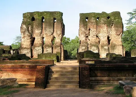
Sigiriya is a human settlement and a UNESCO World Heritage Site located in Sigiriya, Sri Lanka. It is one of the sights of the country on this site and ranks number 1 by English Wikipedia lookups among the country's sights. The site covers an area of 0.015 square kilometers with a height of 180 meters and an elevation of 349 meters.
Planning a visit
The site is open from 7:00 to 17:30. Weather conditions vary through the year, with drier months like June, July, and August experiencing lower rainfall totals between 33 mm and 43 mm, while months like November receive up to 284 mm of rain across about 25 days. Daily temperatures range from a low of 20 °C in January and February to a high of 33 °C in April, May, and September.
Sigiriya is located 150 km from the capital Sri Jayawardenepura Kotte. The nearest airport is China Bay Airport in Trincomalee, situated 80 km away, while Bandaranaike International Colombo Airport is 129 km away. Nearby places to combine with a trip include Dambulla cave temple at 16.5 km and Polonnaruwa at 26.6 km.
Weather by month
The warmest month is April, with an average high of 33 °C. The wettest is November, with about 284 mm of rain.
| Jan | Feb | Mar | Apr | May | Jun | Jul | Aug | Sep | Oct | Nov | Dec | |
|---|---|---|---|---|---|---|---|---|---|---|---|---|
| Average high, °C | 27 | 29 | 32 | 33 | 33 | 32 | 32 | 33 | 33 | 31 | 29 | 27 |
| Average low, °C | 21 | 20 | 22 | 24 | 25 | 24 | 24 | 24 | 24 | 23 | 22 | 21 |
| Rainfall, mm | 134 | 74 | 74 | 143 | 83 | 33 | 43 | 38 | 71 | 216 | 284 | 213 |
| Rainy days | 12 | 9 | 12 | 21 | 20 | 10 | 9 | 11 | 15 | 24 | 25 | 21 |
Temperatures and rainfall: 1981–2010 averages for this spot (4 km grid), from CHELSA. Rainy days: 2015–2024, NASA POWER.