Great Smoky Mountains National Park Great Smoky Mountains National Park (en anglais)
Pigeon Forge, United States UNESCO World Heritage Site
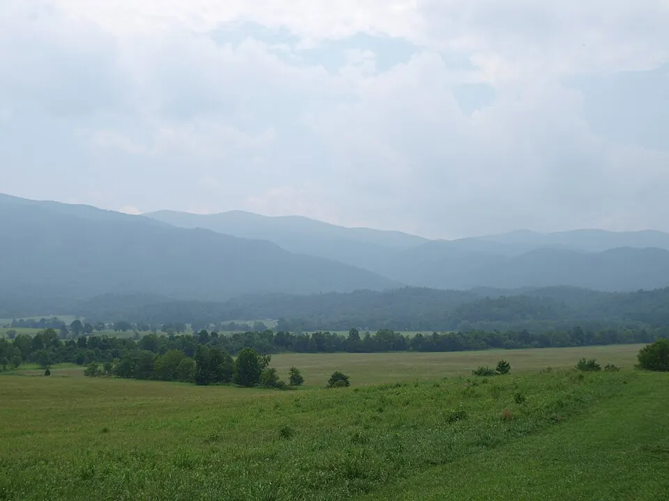
Great Smoky Mountains National Park is a national park in the United States and a World Heritage Site located within the Great Smoky Mountains. The park covers an area of about 2,114 km² and is managed by the National Park Service.
Planning a visit
The weather varies throughout the year. The warmest months are July and August, with daily highs of 22 °C and 21 °C. The coldest months are January and February, with daily highs of 4 °C and 5 °C and lows reaching as low as -6 °C. Rainfall is highest in July, with about 22 rainy days, while October has the fewest rainy days at about 9.
To reach the park, you can fly into McGhee Tyson Airport in Knoxville/Maryville, which is 56 km away. The park is located about 673 km from Washington, D.C. For more information, you can visit the official website at https://nps.gov/grsm.
Weather by month
The warmest month is July, with an average high of 22 °C. Rain is spread fairly evenly through the year.
| Jan | Feb | Mar | Apr | May | Jun | Jul | Aug | Sep | Oct | Nov | Dec | |
|---|---|---|---|---|---|---|---|---|---|---|---|---|
| Average high, °C | 4 | 5 | 9 | 13 | 17 | 20 | 22 | 21 | 19 | 14 | 10 | 5 |
| Average low, °C | -6 | -5 | -2 | 2 | 6 | 11 | 13 | 12 | 9 | 4 | -1 | -4 |
| Rainfall, mm | 162 | 179 | 161 | 147 | 159 | 161 | 175 | 139 | 116 | 92 | 140 | 159 |
| Rainy days | 12 | 14 | 13 | 12 | 16 | 18 | 22 | 20 | 12 | 9 | 9 | 12 |
Temperatures and rainfall: 1981–2010 averages for this spot (4 km grid), from CHELSA. Rainy days: 2015–2024, NASA POWER.