Manuel Antonio National Park
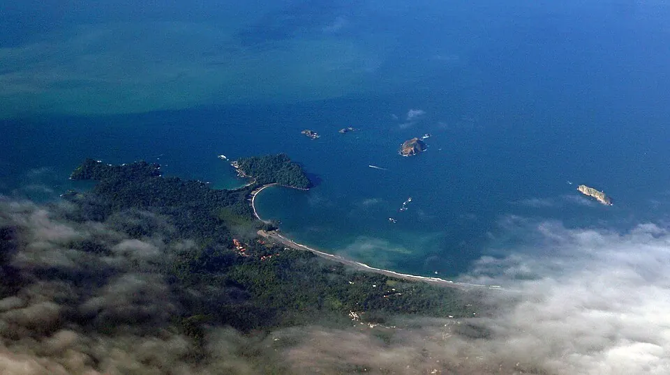
Established in 1972, Manuel Antonio National Park is a national park situated in the Quepos Canton of Costa Rica. The site spans 682 km² and sits at an elevation of 50 meters. It ranks as one of the most looked-up sights in the country among the 10 sights of Costa Rica featured on this site.
Planning a visit
The best time for a visit is during the drier months of the year. February receives the least rainfall, with 106 mm over about 8 days. January and March also offer drier conditions, with roughly 12 rainy days each. From May through November, rainfall is frequent, occurring on nearly every day of the month, with totals peaking at 781 mm in October. Temperatures stay consistent throughout the year, averaging between 25 °C and 27 °C.
Travelers can reach the park from San José, which is 62 km away. The nearest international gateway is Juan Santamaría International Airport (SJO) in San José, located 69 km from the park. A closer option is the Quepos Managua Airport (XQP), which is 8 km away. The park operates Tuesday through Sunday from 07:00 to 16:00.
Weather by month
Temperatures stay much the same all year, around 26 °C on average. The wettest is October, with about 781 mm of rain.
| Jan | Feb | Mar | Apr | May | Jun | Jul | Aug | Sep | Oct | Nov | Dec | |
|---|---|---|---|---|---|---|---|---|---|---|---|---|
| Average temperature, °C | 26 | 26 | 27 | 26 | 26 | 26 | 26 | 26 | 25 | 25 | 25 | 25 |
| Rainfall, mm | 162 | 106 | 106 | 295 | 600 | 546 | 597 | 709 | 675 | 781 | 595 | 324 |
| Rainy days | 12 | 8 | 12 | 23 | 30 | 30 | 30 | 31 | 30 | 31 | 29 | 21 |
Temperatures and rainfall: 1981–2010 averages for this spot (4 km grid), from CHELSA. Rainy days: 2015–2024, NASA POWER.