Tash Rabat
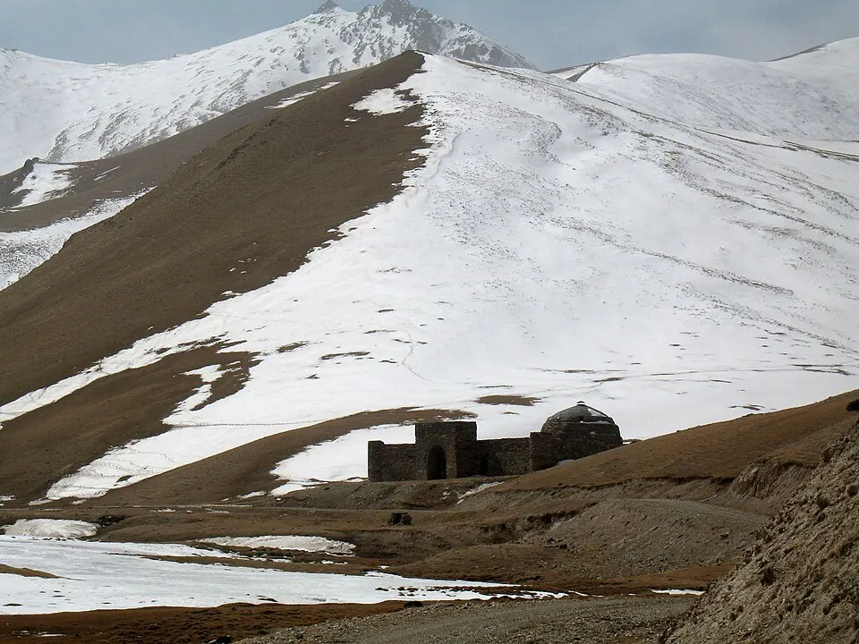
Tash Rabat is an archaeological site that functioned as a caravanserai. Situated in the Naryn Region of Kyrgyzstan at an elevation of 3,500 meters, it is one of the most looked-up sights in the country.
Planning a visit
The climate at Tash Rabat is cold year-round. Temperatures are warmest from June through August, with highs reaching 13 °C and lows around 2 °C. These months are the most suitable for a visit, though rain occurs on about 6 to 10 days during this period. Winter months are significantly colder, with temperatures frequently dropping well below freezing.
Tash Rabat is located 235 km from Bishkek. The nearest airport is Kashgar Laining International Airport in China, located 155 km away. Visitors should prepare for the high elevation of 3,500 meters.
Weather by month
The warmest month is July, with an average high of 13 °C. The wettest is June, with about 109 mm of rain.
| Jan | Feb | Mar | Apr | May | Jun | Jul | Aug | Sep | Oct | Nov | Dec | |
|---|---|---|---|---|---|---|---|---|---|---|---|---|
| Average high, °C | -13 | -10 | -6 | 0 | 5 | 10 | 13 | 13 | 9 | 1 | -6 | -12 |
| Average low, °C | -23 | -21 | -16 | -10 | -6 | -1 | 2 | 2 | -2 | -10 | -18 | -22 |
| Rainfall, mm | 14 | 18 | 33 | 44 | 85 | 109 | 100 | 67 | 38 | 31 | 19 | 18 |
| Rainy days | 3 | 4 | 7 | 8 | 10 | 10 | 7 | 6 | 3 | 5 | 6 | 4 |
Temperatures and rainfall: 1981–2010 averages for this spot (4 km grid), from CHELSA. Rainy days: 2015–2024, NASA POWER.