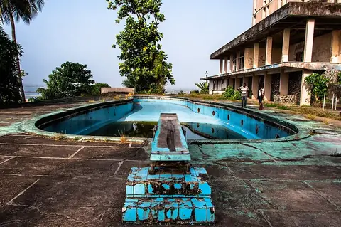
Sapo National Park
Sapo National Park is a national park located in Sinoe County, Liberia. Established in 1983, it covers an area of 1,804 square kilometers and is one of the most looked-up sights in the country.
Planning a visit
The park experiences high rainfall throughout the year, with the lowest precipitation occurring in January, which sees about 51 mm of rain over 9 days, and December, with 66 mm over 12 days. During these drier months, daily high temperatures reach 29 °C to 30 °C. Rainfall increases significantly from May through October, often exceeding 250 mm monthly, which may complicate travel within the park.
To reach Sapo National Park, visitors typically travel from Monrovia, which is located 266 km away. The nearest airport is Roberts International Airport (ROB), situated 217 km from the park.
Weather by month
The warmest month is April, with an average high of 30 °C. The wettest is June, with about 297 mm of rain.
| Jan | Feb | Mar | Apr | May | Jun | Jul | Aug | Sep | Oct | Nov | Dec | |
|---|---|---|---|---|---|---|---|---|---|---|---|---|
| Average high, °C | 30 | 30 | 30 | 30 | 30 | 28 | 27 | 27 | 28 | 29 | 29 | 29 |
| Average low, °C | 22 | 23 | 23 | 23 | 22 | 22 | 22 | 22 | 22 | 22 | 22 | 22 |
| Rainfall, mm | 51 | 100 | 181 | 202 | 255 | 297 | 188 | 224 | 290 | 258 | 142 | 66 |
| Rainy days | 9 | 15 | 22 | 23 | 26 | 29 | 23 | 26 | 30 | 30 | 23 | 12 |
Temperatures and rainfall: 1981–2010 averages for this spot (4 km grid), from CHELSA. Rainy days: 2015–2024, NASA POWER.