Mayon
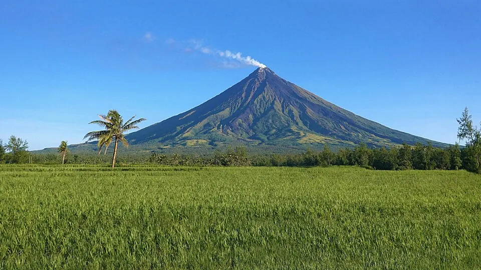
Mayon is a stratovolcano reaching an elevation of 2,462 meters in the Albay province of the Bicol Region. Composed of andesite, basaltic andesite, basalt, and picrobasalt, it stands as the most looked-up sight in the Philippines.
Planning a visit
The mountain is located 328 kilometers from Manila. Travelers can fly into Bicol International Airport in Legazpi, which is 16 kilometers away. For a shorter trip, the Cagsawa Ruins are 10.2 kilometers from the site.
Temperatures remain consistent throughout the year, with highs between 20 °C and 24 °C and lows between 16 °C and 18 °C. Rain occurs frequently in every month. Precipitation is highest from October through January, with monthly totals ranging from 396 mm to 643 mm and rainy days occurring on nearly every day of those months. April and May experience slightly less rain, with 208 mm recorded over 19 to 22 days.
Weather by month
The warmest month is May, with an average high of 24 °C. The wettest is December, with about 643 mm of rain.
| Jan | Feb | Mar | Apr | May | Jun | Jul | Aug | Sep | Oct | Nov | Dec | |
|---|---|---|---|---|---|---|---|---|---|---|---|---|
| Average high, °C | 20 | 21 | 22 | 24 | 24 | 24 | 23 | 23 | 23 | 23 | 22 | 21 |
| Average low, °C | 16 | 16 | 16 | 17 | 18 | 18 | 18 | 18 | 17 | 17 | 17 | 16 |
| Rainfall, mm | 404 | 286 | 220 | 208 | 208 | 210 | 278 | 233 | 320 | 396 | 549 | 643 |
| Rainy days | 27 | 22 | 20 | 19 | 22 | 26 | 30 | 27 | 28 | 28 | 29 | 30 |
Temperatures and rainfall: 1981–2010 averages for this spot (4 km grid), from CHELSA. Rainy days: 2015–2024, NASA POWER.