Kebnekaise
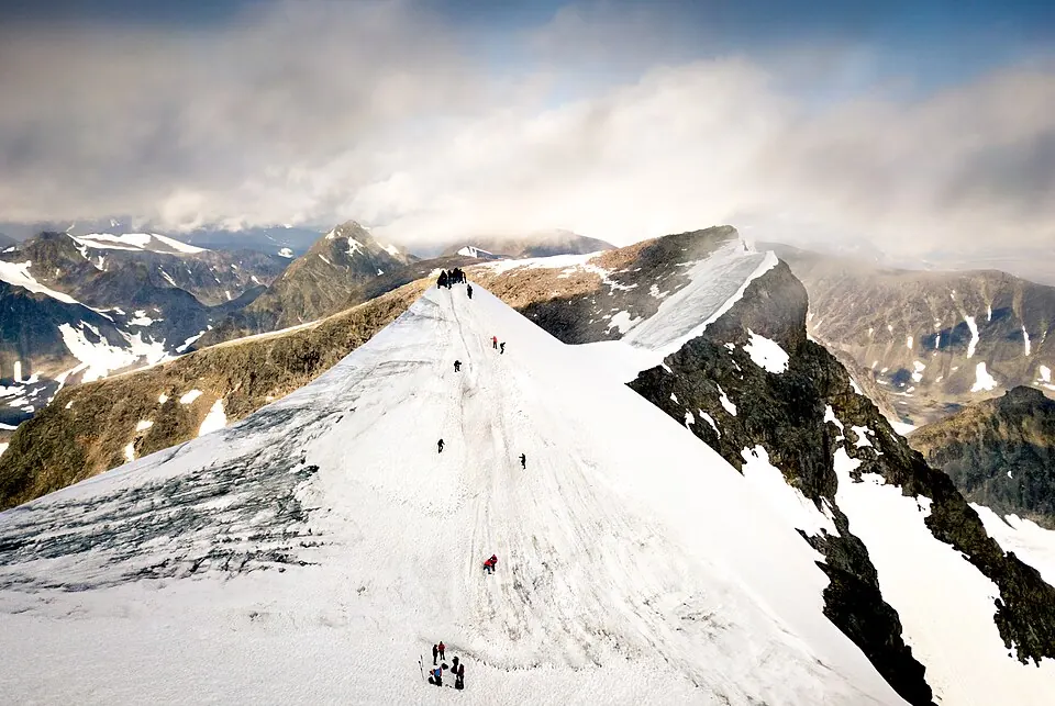
Kebnekaise is a mountain massif and the highest point in Sweden, located in the Scandinavian Mountains within Kiruna Municipality. It is one of the 8 most looked-up sights in the country on English Wikipedia.
Planning a visit
The weather at the massif changes according to the season. July is the warmest month, with average daily highs of 9 °C and lows of 4 °C, but it is also the wettest month with about 176 mm of rain over 23 days. In August, highs are about 8 °C and lows are 2 °C. The coldest period occurs from December to February, when daily highs are about -12 °C and lows reach -18 °C. During the spring months of March and April, daily highs range from -10 °C to -6 °C.
To reach the area, the nearest airport is Kiruna Airport, which is located 75 km away from the site. Kebnekaise is approximately 950 km from the capital, Stockholm.
Weather by month
The warmest month is July, with an average high of 9 °C. The wettest is July, with about 176 mm of rain.
| Jan | Feb | Mar | Apr | May | Jun | Jul | Aug | Sep | Oct | Nov | Dec | |
|---|---|---|---|---|---|---|---|---|---|---|---|---|
| Average high, °C | -12 | -12 | -10 | -6 | 0 | 5 | 9 | 8 | 2 | -4 | -9 | -11 |
| Average low, °C | -18 | -18 | -15 | -10 | -5 | 0 | 4 | 2 | -2 | -8 | -14 | -17 |
| Rainfall, mm | 97 | 72 | 60 | 48 | 74 | 106 | 176 | 123 | 110 | 110 | 79 | 82 |
| Rainy days | 20 | 19 | 20 | 20 | 21 | 20 | 23 | 24 | 20 | 21 | 19 | 21 |
Temperatures and rainfall: 1981–2010 averages for this spot (4 km grid), from CHELSA. Rainy days: 2015–2024, NASA POWER.