Togo
Country · Africa, Western Africa
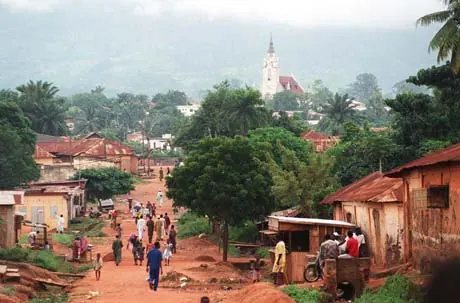
Togo is a country in Western Africa bordered by Benin, Burkina Faso, and Ghana. Its capital is Lomé, and the country covers 56,785 square kilometres with a population of about 8.6 million in 2025. It offers travellers a mix of cultural sights and local cuisine.
Highlights
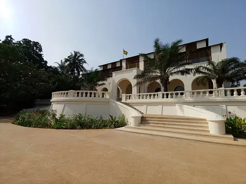
The site covers 1 sight, the Palace of the Governors. Additional locations worth a look include the Sacred Heart Cathedral in Lomé.
Food and drink
Local dishes to try include Banku and Eba.
When to go
This weather data applies to the capital, Lomé. January and December are relatively dry, with high temperatures of 29 °C and low temperatures of 25 °C to 26 °C, and minimal rainfall. Rain increases significantly from April through July, with June experiencing 187 mm of rain on about 26 days. August brings a temporary drop in rainfall with 35 mm over about 13 days, alongside daily highs of 26 °C and lows of 23 °C.
Practical notes
The currency is the West African CFA franc. The official language is French. The electrical system operates at 220.0 volts using plug type C. Driving is on the right side of the road. The time zone is UTC±00:00.
Food and drink to try in Togo
- Banku
- Eba
Top sights in Togo
Weather by month
The warmest month is March, with an average high of 30 °C. The wettest is June, with about 187 mm of rain.
| Jan | Feb | Mar | Apr | May | Jun | Jul | Aug | Sep | Oct | Nov | Dec | |
|---|---|---|---|---|---|---|---|---|---|---|---|---|
| Average high, °C | 29 | 30 | 30 | 30 | 29 | 28 | 26 | 26 | 27 | 28 | 29 | 29 |
| Average low, °C | 25 | 26 | 27 | 27 | 26 | 25 | 24 | 23 | 24 | 25 | 26 | 26 |
| Rainfall, mm | 9 | 25 | 55 | 98 | 149 | 187 | 73 | 35 | 80 | 84 | 31 | 13 |
| Rainy days | 4 | 10 | 23 | 25 | 27 | 26 | 18 | 13 | 24 | 28 | 16 | 5 |
Temperatures and rainfall: 1981–2010 averages for Lomé (4 km grid), from CHELSA. Rainy days: 2015–2024, NASA POWER.
Also worth a look
- Sacred Heart Cathedral, Lomé