Delmarva Peninsula
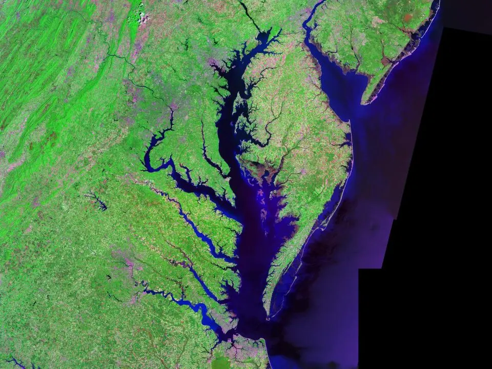
The Delmarva Peninsula is a peninsula in the United States that includes parts of Delaware, Maryland, and Virginia. It is one of the 120 sights of the United States listed on this site and is ranked 118th in popularity among the country's sights by English Wikipedia lookups.
Planning a visit
The climate varies throughout the year. The warmest months are July and August, with daily highs reaching 30 °C and 29 °C respectively, though these months also see the most rain, with about 17 rainy days in July and 16 in August. For cooler weather, October has highs of 20 °C and lows of 12 °C, while January is the coldest month with a high of 7 °C and a low of -1 °C.
To reach the peninsula, you can fly into Salisbury Ocean City Wicomico Regional Airport, which is 18 km away. Baltimore/Washington International Thurgood Marshall Airport is a larger hub located 126 km away. The peninsula is approximately 140 km from the capital, Washington, D.C.
Weather by month
The warmest month is July, with an average high of 30 °C. Rain is spread fairly evenly through the year.
| Jan | Feb | Mar | Apr | May | Jun | Jul | Aug | Sep | Oct | Nov | Dec | |
|---|---|---|---|---|---|---|---|---|---|---|---|---|
| Average high, °C | 7 | 8 | 13 | 19 | 23 | 28 | 30 | 29 | 26 | 20 | 15 | 9 |
| Average low, °C | -1 | 0 | 3 | 8 | 14 | 19 | 22 | 21 | 18 | 12 | 7 | 1 |
| Rainfall, mm | 86 | 81 | 109 | 94 | 97 | 100 | 113 | 126 | 104 | 88 | 88 | 91 |
| Rainy days | 10 | 10 | 11 | 10 | 13 | 13 | 17 | 16 | 11 | 8 | 8 | 9 |
Temperatures and rainfall: 1981–2010 averages for this spot (4 km grid), from CHELSA. Rainy days: 2015–2024, NASA POWER.