Fort Sumter
Charleston, United States
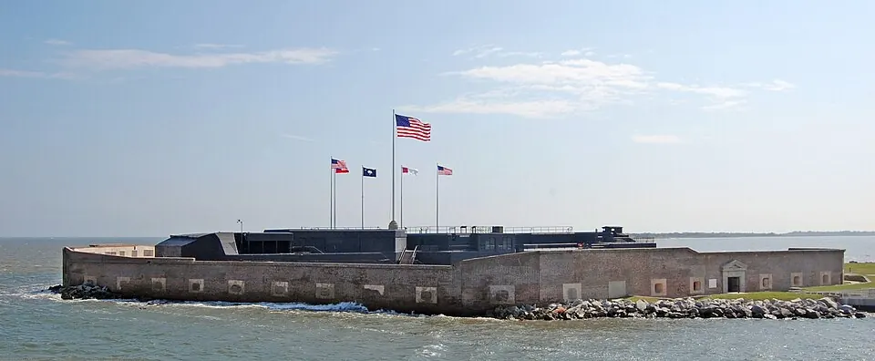
Fort Sumter is a sea fort and a National Register of Historic Places contributing property. It is part of the Fort Sumter and Fort Moultrie National Historical Park.
Planning a visit
The site is open from 9:00 to 17:00. Visitors can reach the area via Charleston International Airport, which is 22 km away. The fort is located 729 km from Washington, D.C. It can be combined with a visit to other parts of the Fort Sumter and Fort Moultrie National Historical Park.
Temperatures vary by month. The warmest months are July and August, with daily highs reaching about 30 °C and 29 °C. These months also have the most rain, with about 150 mm to 176 mm of rainfall. The coolest month is January, with a high of 14 °C and a low of 8 °C. November is the driest month, with about 65 mm of rain over 8 days. June and July are the wettest months, seeing up to 23 rainy days in July.
Weather by month
The warmest month is July, with an average high of 30 °C. The wettest is August, with about 176 mm of rain.
| Jan | Feb | Mar | Apr | May | Jun | Jul | Aug | Sep | Oct | Nov | Dec | |
|---|---|---|---|---|---|---|---|---|---|---|---|---|
| Average high, °C | 15 | 16 | 18 | 22 | 26 | 29 | 30 | 29 | 27 | 24 | 20 | 16 |
| Average low, °C | 8 | 9 | 12 | 15 | 20 | 24 | 25 | 25 | 23 | 18 | 14 | 9 |
| Rainfall, mm | 93 | 81 | 99 | 78 | 67 | 122 | 150 | 176 | 150 | 104 | 65 | 85 |
| Rainy days | 9 | 9 | 10 | 9 | 12 | 17 | 23 | 22 | 14 | 8 | 8 | 10 |
Temperatures and rainfall: 1981–2010 averages for this spot (4 km grid), from CHELSA. Rainy days: 2015–2024, NASA POWER.