Great Lakes
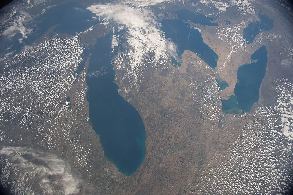
The Great Lakes are a group of five interconnected lakes located in the United States. Covering an area of about 208,600 square kilometers, they rank as the 8th most looked-up sight in the country on English Wikipedia.
Planning a visit
The region experiences cold winters with daily highs dropping to -5 °C in February and warm summers with highs reaching 22 °C in July and August. Rain is distributed throughout the year, with the highest frequency of rainy days occurring in October and December. Summer months provide the most comfortable weather for outdoor activities.
The nearest airport is Pellston Regional Airport of Emmet County Airport in Pellston, located 65 km away. Travelers can also fly into Gerald R. Ford International Airport in Grand Rapids, which is 341 km from the lakes. The area is 952 km from Washington, D.C.
Weather by month
The warmest month is August, with an average high of 23 °C. Rain is spread fairly evenly through the year.
| Jan | Feb | Mar | Apr | May | Jun | Jul | Aug | Sep | Oct | Nov | Dec | |
|---|---|---|---|---|---|---|---|---|---|---|---|---|
| Average high, °C | -4 | -5 | -1 | 4 | 9 | 16 | 22 | 23 | 19 | 13 | 6 | 1 |
| Average low, °C | -9 | -10 | -7 | -1 | 5 | 12 | 18 | 19 | 15 | 9 | 3 | -3 |
| Rainfall, mm | 49 | 37 | 47 | 63 | 69 | 76 | 75 | 85 | 94 | 89 | 70 | 59 |
| Rainy days | 12 | 12 | 11 | 15 | 14 | 14 | 14 | 14 | 13 | 17 | 15 | 16 |
Temperatures and rainfall: 1981–2010 averages for this spot (4 km grid), from CHELSA. Rainy days: 2015–2024, NASA POWER.