Tassili n'Ajjer ⵜⴰⵙⵉⵍⵉ ⵏ ⴰⵣⴶⵔ
Algeria UNESCO World Heritage Site
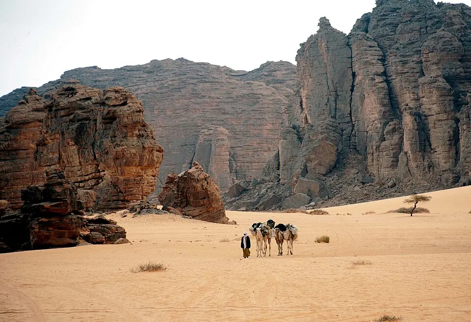
Tassili n'Ajjer is a mountain range and archaeological site located in Algeria. It is recognized as a World Heritage Site and a Ramsar site, forming part of the Sahara, the Algerian Desert, and Tassili Cultural Park. It is one of the most looked-up sights in the country on English Wikipedia.
Planning a visit
The site experiences varied temperatures throughout the year. January and December are cooler, with daily highs around 18 °C to 20 °C and lows of 4 °C to 6 °C. Months like June and July reach daily highs of 38 °C with lows around 23 °C to 24 °C. Rainfall is minimal across all months, typically staying between 0 mm and 4 mm.
The nearest airport is Illizi Takhamalt Airport in Illizi, located 123 km away, while Tiska Djanet Airport in Djanet is 161 km away. The capital, Algiers, is 1358 km away.
Weather by month
The warmest month is June, with an average high of 38 °C. Rain is spread fairly evenly through the year.
| Jan | Feb | Mar | Apr | May | Jun | Jul | Aug | Sep | Oct | Nov | Dec | |
|---|---|---|---|---|---|---|---|---|---|---|---|---|
| Average high, °C | 18 | 21 | 26 | 32 | 36 | 38 | 38 | 37 | 36 | 31 | 25 | 20 |
| Average low, °C | 4 | 7 | 11 | 16 | 21 | 24 | 23 | 23 | 22 | 17 | 11 | 6 |
| Rainfall, mm | 2 | 1 | 3 | 1 | 2 | 4 | 0 | 1 | 3 | 3 | 1 | 1 |
| Rainy days | 0 | 0 | 0 | 0 | 1 | 1 | 0 | 1 | 1 | 1 | 0 | 0 |
Temperatures and rainfall: 1981–2010 averages for this spot (4 km grid), from CHELSA. Rainy days: 2015–2024, NASA POWER.