Uluṟu-Kata Tjuṯa National Park
Australia UNESCO World Heritage Site
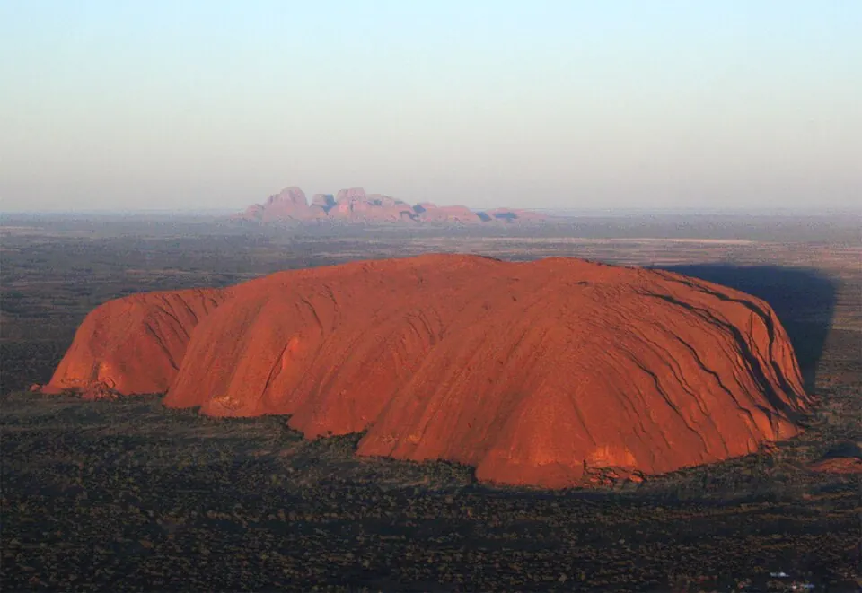
Uluṟu-Kata Tjuṯa National Park is a World Heritage Site in Australia that serves as a natural and indigenous cultural heritage site. It covers an area of 1,334 km² and is listed on both the Australian National Heritage List and the Commonwealth Heritage List.
Planning a visit
The park experiences high temperatures from December to March, with daily highs reaching 33 °C to 37 °C. The coolest months are June and July, when daily highs are around 19 °C and lows reach 6 °C. Rainfall is relatively low throughout the year, with the wettest month being March, which averages 48 mm of rain.
Visitors can fly into Ayers Rock Connellan Airport in Yulara, which is 15 km from the park. The site is 2,059 km from Canberra. While visiting, you can see Uluru, located 5.7 km away, or Kata Tjuta, which is 22.9 km away. Opening hours vary by month; for example, from June to July, the park is open daily from 06:30 to 19:30, while in December, it is open daily from 05:00 to 21:00.
Weather by month
The warmest month is January, with an average high of 37 °C. Rain is spread fairly evenly through the year.
| Jan | Feb | Mar | Apr | May | Jun | Jul | Aug | Sep | Oct | Nov | Dec | |
|---|---|---|---|---|---|---|---|---|---|---|---|---|
| Average high, °C | 37 | 36 | 33 | 29 | 23 | 19 | 19 | 22 | 28 | 32 | 34 | 36 |
| Average low, °C | 24 | 23 | 20 | 16 | 11 | 7 | 6 | 8 | 13 | 17 | 20 | 22 |
| Rainfall, mm | 42 | 41 | 48 | 12 | 17 | 18 | 14 | 7 | 11 | 17 | 32 | 40 |
| Rainy days | 4 | 2 | 2 | 1 | 2 | 2 | 0 | 1 | 2 | 2 | 3 | 2 |
Temperatures and rainfall: 1981–2010 averages for this spot (4 km grid), from CHELSA. Rainy days: 2015–2024, NASA POWER.