Royal Manas National Park
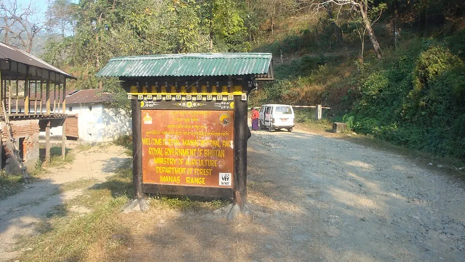
Established in 1966, Royal Manas National Park is a national park in Bhutan covering 1,057 km2. It is currently listed as a Tentative World Heritage Site and ranks as the 6th most looked-up sight in the country on English Wikipedia.
Planning a visit
The driest and coolest months to visit are November, December, and January, which see minimal rainfall and daily highs between 13 °C and 18 °C. Rainfall increases significantly starting in April and peaks in July with 917 mm of rain. Temperatures remain relatively stable throughout the year, with highs ranging from 13 °C to 23 °C.
The park is 128 km from the capital, Thimphu. The nearest airport is Bathpalathang Airport in Jakar, located 74 km away, while the international hub, Lokpriya Gopinath Bordoloi International Airport in Guwahati, India, is 121 km away. You can combine a trip here with a visit to Manas National Park, which is 26.8 km away.
Weather by month
The warmest month is August, with an average high of 23 °C. The wettest is July, with about 917 mm of rain.
| Jan | Feb | Mar | Apr | May | Jun | Jul | Aug | Sep | Oct | Nov | Dec | |
|---|---|---|---|---|---|---|---|---|---|---|---|---|
| Average high, °C | 13 | 15 | 18 | 20 | 21 | 22 | 22 | 23 | 22 | 21 | 18 | 15 |
| Average low, °C | 4 | 6 | 9 | 12 | 15 | 17 | 18 | 18 | 16 | 13 | 9 | 6 |
| Rainfall, mm | 18 | 46 | 70 | 220 | 367 | 685 | 917 | 555 | 468 | 152 | 15 | 13 |
| Rainy days | 1 | 3 | 8 | 19 | 24 | 27 | 28 | 25 | 21 | 12 | 1 | 1 |
Temperatures and rainfall: 1981–2010 averages for this spot (4 km grid), from CHELSA. Rainy days: 2015–2024, NASA POWER.