Mount Cameroon
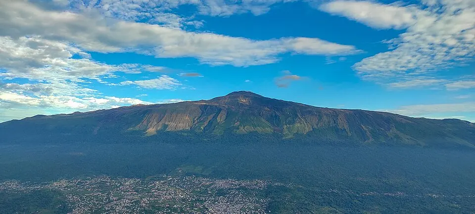
Mount Cameroon is a mountain and volcano located in Fako, Cameroon, reaching an elevation of 4095 meters in the Cameroon line mountain range. It is made of basalt. It is one of the most looked-up sights in Cameroon on English Wikipedia.
Planning a visit
January and December are the driest months, with rain of 43 mm on about 3 days and 42 mm on about 5 days respectively, alongside daily highs of 11 °C and lows of 5 °C. In contrast, July and August experience the heaviest rain, reaching 914 mm and 935 mm across almost the entire month, with daily highs around 8 °C to 9 °C and lows of 5 °C.
The nearest airport is Douala International Airport, located 65 km away. The sight is 263 km from the capital, Yaoundé.
Weather by month
The warmest month is February, with an average high of 12 °C. The wettest is August, with about 935 mm of rain.
| Jan | Feb | Mar | Apr | May | Jun | Jul | Aug | Sep | Oct | Nov | Dec | |
|---|---|---|---|---|---|---|---|---|---|---|---|---|
| Average high, °C | 11 | 12 | 12 | 12 | 11 | 10 | 9 | 9 | 9 | 10 | 11 | 11 |
| Average low, °C | 5 | 6 | 6 | 7 | 7 | 6 | 5 | 5 | 5 | 6 | 6 | 5 |
| Rainfall, mm | 43 | 67 | 209 | 308 | 416 | 592 | 914 | 935 | 660 | 467 | 208 | 42 |
| Rainy days | 3 | 9 | 22 | 23 | 26 | 27 | 28 | 30 | 28 | 29 | 20 | 5 |
Temperatures and rainfall: 1981–2010 averages for this spot (4 km grid), from CHELSA. Rainy days: 2015–2024, NASA POWER.