Cerro El Pital
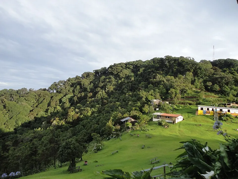
Cerro El Pital is a mountain located in the Chalatenango Department of El Salvador, within the Sierra Madre de Chiapas mountain range. It reaches an elevation of 2,730 meters and stands as one of the most looked-up sights in the country on English Wikipedia.
Planning a visit
The mountain experiences lower rain amounts from November to March, with January and February seeing daily highs of 17 °C to 18 °C and lows of 8 °C, along with 7 to 8 mm of rain. The rain increases significantly between May and October, peaking in September with 323 mm of rain across 26 days.
The nearest airport is Ilopango International Airport in San Salvador, located 76 km away, while El Salvador International Airport Saint Óscar Arnulfo Romero y Galdámez in San Salvador is 105 km away. The mountain is 77 km from the capital, San Salvador. A trip can be combined with a visit to Cihuatán, which is 45 km away.
Weather by month
The warmest month is April, with an average high of 20 °C. The wettest is September, with about 323 mm of rain.
| Jan | Feb | Mar | Apr | May | Jun | Jul | Aug | Sep | Oct | Nov | Dec | |
|---|---|---|---|---|---|---|---|---|---|---|---|---|
| Average high, °C | 17 | 19 | 20 | 20 | 19 | 18 | 18 | 18 | 17 | 17 | 16 | 17 |
| Average low, °C | 8 | 8 | 9 | 10 | 10 | 11 | 11 | 11 | 10 | 10 | 9 | 8 |
| Rainfall, mm | 7 | 8 | 14 | 53 | 171 | 306 | 276 | 270 | 323 | 158 | 35 | 14 |
| Rainy days | 7 | 5 | 6 | 9 | 19 | 25 | 21 | 25 | 27 | 21 | 15 | 9 |
Temperatures and rainfall: 1981–2010 averages for this spot (4 km grid), from CHELSA. Rainy days: 2015–2024, NASA POWER.