Mount Kenya
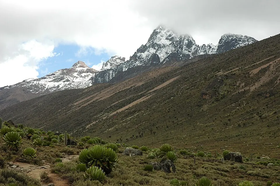
Mount Kenya is a mountain in Kenya reaching an elevation of 5,199 m. It is part of the Great Rift Valley and the Seven Second Summits, with its material consisting of syenite. It ranks as the second most looked-up sight in English Wikipedia among the country's sights.
Planning a visit
Temperature highs range from 14 °C in July to 18 °C in February and March, while lows range from 7 °C in July and August to 9 °C in April and May. Rain varies significantly throughout the year. April experiences the most rain with 461 mm over about 26 days, followed by November with 326 mm over about 28 days and October with 368 mm over about 21 days. February sees lower rainfall with 94 mm over about 10 days, and January has 120 mm over about 11 days.
The nearest airport is Nanyuki Civil Airport in Gathiuru, Kenya, located 18 km away. Jomo Kenyatta International Airport in Nairobi serves as a hub and is 139 km away. The distance from the capital, Nairobi, is also 139 km.
Weather by month
The warmest month is March, with an average high of 18 °C. The wettest is April, with about 461 mm of rain.
| Jan | Feb | Mar | Apr | May | Jun | Jul | Aug | Sep | Oct | Nov | Dec | |
|---|---|---|---|---|---|---|---|---|---|---|---|---|
| Average high, °C | 17 | 18 | 18 | 17 | 17 | 15 | 15 | 15 | 16 | 16 | 16 | 16 |
| Average low, °C | 8 | 8 | 8 | 9 | 9 | 8 | 7 | 7 | 7 | 8 | 8 | 8 |
| Rainfall, mm | 120 | 94 | 186 | 461 | 360 | 119 | 118 | 139 | 110 | 368 | 326 | 165 |
| Rainy days | 11 | 10 | 17 | 26 | 24 | 16 | 22 | 19 | 17 | 21 | 28 | 19 |
Temperatures and rainfall: 1981–2010 averages for this spot (4 km grid), from CHELSA. Rainy days: 2015–2024, NASA POWER.