Mulanje Massif Mount Mulanje
Malawi UNESCO World Heritage Site
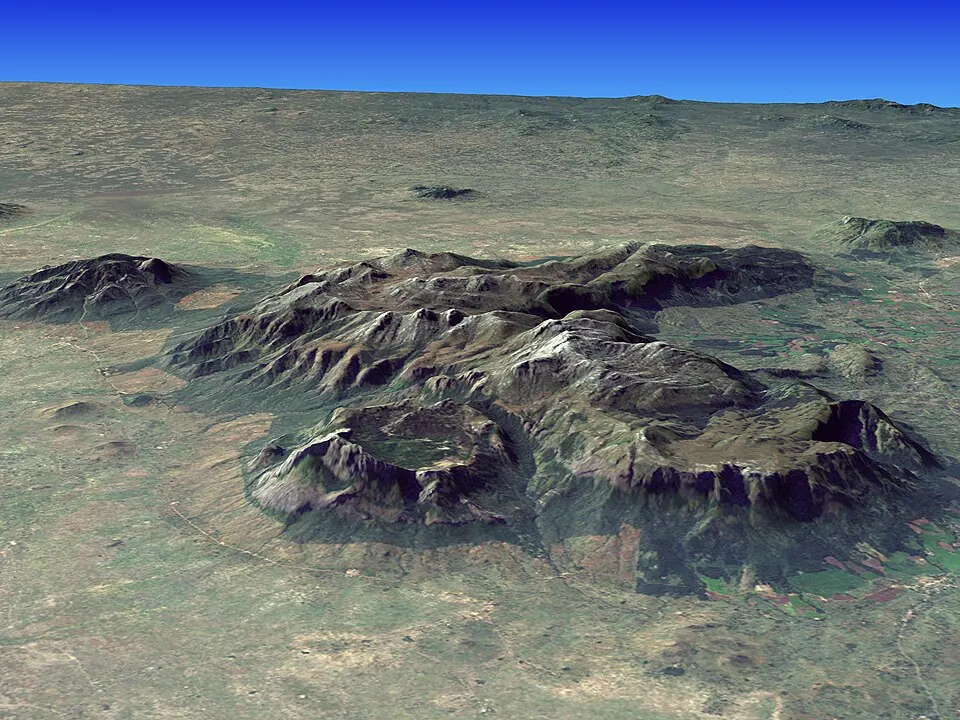
Mulanje Massif is a massif and mountain range in Malawi. It is designated as a World Heritage Site and is one of the most looked-up sights in the country on English Wikipedia. The elevation reaches 3002 m and the length is 26000 m.
Planning a visit
The drier months from May to September experience lower rainfall, with totals between 35 mm and 53 mm and fewer rainy days. In contrast, January sees the highest precipitation with 423 mm of rain over about 27 days, alongside daily temperatures ranging from a high of 18 °C to a low of 11 °C. July is the coolest month with daily highs of 12 °C and lows of 3 °C.
The nearest airport is Chileka International Airport in Blantyre, located 77 km away. The site is 294 km from the capital, Lilongwe.
Weather by month
The warmest month is November, with an average high of 19 °C. The wettest is January, with about 423 mm of rain.
| Jan | Feb | Mar | Apr | May | Jun | Jul | Aug | Sep | Oct | Nov | Dec | |
|---|---|---|---|---|---|---|---|---|---|---|---|---|
| Average high, °C | 18 | 17 | 17 | 16 | 15 | 12 | 12 | 14 | 17 | 19 | 19 | 18 |
| Average low, °C | 11 | 10 | 10 | 8 | 6 | 4 | 3 | 4 | 6 | 8 | 10 | 10 |
| Rainfall, mm | 423 | 327 | 342 | 152 | 53 | 43 | 51 | 35 | 29 | 88 | 149 | 366 |
| Rainy days | 27 | 23 | 22 | 15 | 6 | 8 | 9 | 4 | 2 | 5 | 12 | 21 |
Temperatures and rainfall: 1981–2010 averages for this spot (4 km grid), from CHELSA. Rainy days: 2015–2024, NASA POWER.