Marshall Islands
Country · Oceania, Micronesia
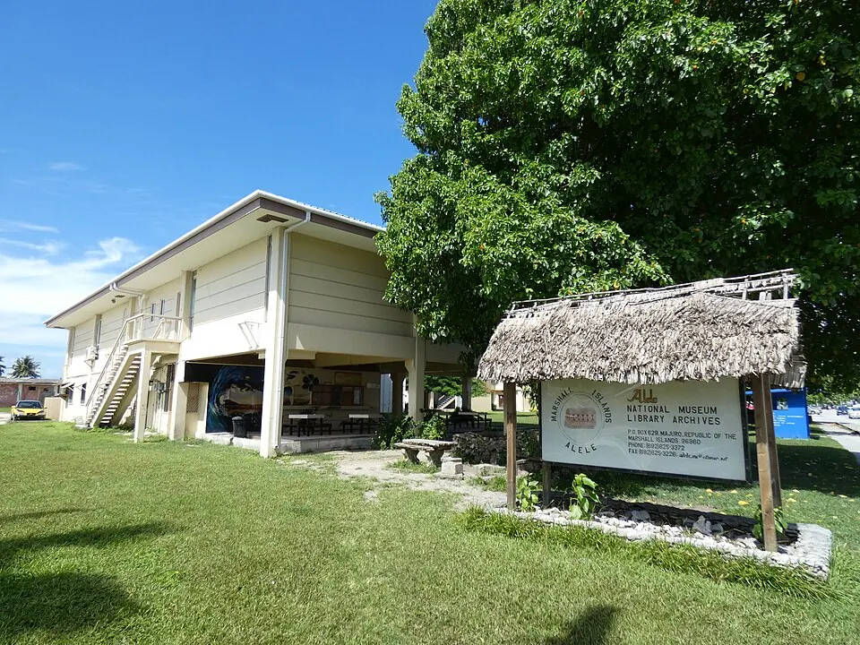
The Marshall Islands are a country in the Micronesia subregion of Oceania. With a population of about 36,000 people and a total area of 181 square kilometers, the nation is centered around its capital, Majuro.
Highlights
This site covers one sight in the Marshall Islands, the Alele Museum & Public Library. The country also features the Likiep Atoll, which is its highest point.
When to go
The climate at the capital, Majuro, remains consistent throughout the year with average temperatures of 27 °C in every month. Rainfall is significant year-round. The driest months are February and March, which see 198 mm and 197 mm of rain respectively, while October and November are the wettest, with over 340 mm of rain each. Visitors should expect rain on most days of the month regardless of the time of year.
Practical notes
The official currency is the United States dollar. English and Marshallese are the official languages. The country operates on UTC+12:00 time and uses a right-hand driving system. The country code for calling is +692, and the internet top-level domain is .mh.
Top sights in Marshall Islands
Weather by month
Temperatures stay much the same all year, around 27 °C on average. Rain is spread fairly evenly through the year.
| Jan | Feb | Mar | Apr | May | Jun | Jul | Aug | Sep | Oct | Nov | Dec | |
|---|---|---|---|---|---|---|---|---|---|---|---|---|
| Average temperature, °C | 27 | 27 | 27 | 27 | 27 | 27 | 27 | 27 | 27 | 27 | 27 | 27 |
| Rainfall, mm | 212 | 198 | 197 | 258 | 268 | 287 | 324 | 302 | 317 | 343 | 346 | 304 |
| Rainy days | 20 | 18 | 25 | 27 | 28 | 28 | 29 | 30 | 27 | 29 | 27 | 25 |
Temperatures and rainfall: 1981–2010 averages for Majuro (4 km grid), from CHELSA. Rainy days: 2015–2024, NASA POWER.