Aïr and Ténéré National Nature Reserve
Niger UNESCO World Heritage Site
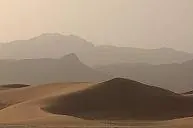
The Aïr and Ténéré National Nature Reserve is a nature reserve located in the Agadez Region of Niger. Established in 1988, this expansive 77,360 square kilometer site is recognized as a World Heritage Site, a Tentative World Heritage Site, and a Ramsar site. It encompasses the Aïr Mountains and is the second most looked-up sight in Niger on English Wikipedia.
Planning a visit
The reserve experiences a desert climate with very little rainfall. The cooler months of December and January, with daily highs around 21 °C to 22 °C and lows of 9 °C to 11 °C, offer the most comfortable temperatures for visiting. From March through September, temperatures regularly exceed 30 °C, peaking at 37 °C in June. Rainfall is minimal throughout the year, with the highest precipitation occurring in August, which sees about 10 days of rain. Because of the extreme heat and dry conditions, careful planning is required for travel within the region.
The reserve is located 889 kilometers from Niamey. The nearest airport is Zinder Airport, situated 469 kilometers away. International travelers may also consider Aguenar – Hadj Bey Akhamok Airport in Tamanrasset, Algeria, which is 650 kilometers from the site. Given the remote location and the vast size of the reserve, visitors should arrange logistics well in advance.
Weather by month
The warmest month is June, with an average high of 37 °C. Rain is spread fairly evenly through the year.
| Jan | Feb | Mar | Apr | May | Jun | Jul | Aug | Sep | Oct | Nov | Dec | |
|---|---|---|---|---|---|---|---|---|---|---|---|---|
| Average high, °C | 21 | 24 | 29 | 34 | 37 | 37 | 36 | 35 | 35 | 31 | 26 | 22 |
| Average low, °C | 9 | 11 | 16 | 21 | 23 | 24 | 23 | 23 | 23 | 20 | 15 | 11 |
| Rainfall, mm | 0 | 0 | 0 | 0 | 6 | 5 | 16 | 26 | 7 | 2 | 0 | 0 |
| Rainy days | 0 | 0 | 0 | 0 | 1 | 2 | 4 | 10 | 3 | 1 | 0 | 0 |
Temperatures and rainfall: 1981–2010 averages for this spot (4 km grid), from CHELSA. Rainy days: 2015–2024, NASA POWER.