The Bahamas
Country · Americas, Caribbean

The Bahamas is a country in the Caribbean region of the Americas, with Nassau as its capital. It covers an area of 13,878 square kilometers and has a population of about 403,000. The country offers travelers a destination featuring island sights and the capital city.
Highlights
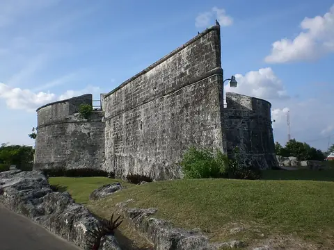
The site covers 2 sights. The city included is Nassau. Top sights to see are Queen's Staircase and Fort Fincastle.
When to go
The climate data is at the capital, Nassau, using average temperatures only. January and February have an average temperature of 22 °C, with rain around 40 to 44 mm. Temperatures rise to 27 °C to 28 °C between June and September, which are also the months with higher rainfall, reaching up to 220 mm in June across about 24 days.
Practical notes
The currency is the Bahamian dollar. The official language is English. Plugs used are type A and B with a voltage of 120.0. Driving is on the left side of the road. The time zone is UTC−05:00.
Cities
Top sights in The Bahamas

Weather by month
The warmest month is August, averaging 28 °C. The wettest is June, with about 220 mm of rain.
| Jan | Feb | Mar | Apr | May | Jun | Jul | Aug | Sep | Oct | Nov | Dec | |
|---|---|---|---|---|---|---|---|---|---|---|---|---|
| Average temperature, °C | 22 | 22 | 23 | 24 | 25 | 27 | 28 | 28 | 27 | 26 | 25 | 23 |
| Rainfall, mm | 40 | 44 | 42 | 44 | 112 | 220 | 145 | 174 | 176 | 137 | 73 | 51 |
| Rainy days | 11 | 6 | 7 | 10 | 18 | 24 | 22 | 24 | 21 | 19 | 12 | 11 |
Temperatures and rainfall: 1981–2010 averages for Nassau (4 km grid), from CHELSA. Rainy days: 2015–2024, NASA POWER.