Rwenzori Mountains National Park
Kasese, Uganda UNESCO World Heritage Site
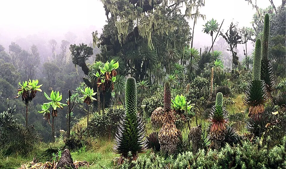
Rwenzori Mountains National Park is a national park in Uganda and a UNESCO World Heritage Site. It is also a Ramsar site covering an area of 996 km². The park is located within the Bundibugyo, Kabarole, and Kasese districts and includes the Rwenzori Mountains. It is the 7th most looked-up sight in Uganda on English Wikipedia.
Planning a visit
The climate features daily highs between 9 °C and 11 °C and daily lows between 0 °C and 2 °C. Rainfall varies by month. The wettest months are April, with 577 mm of rain, and October, with 550 mm. Other months with high rainfall levels include March, May, September, and November. The months with the least rain are January and February, with about 12 rainy days each, and July, with about 15 rainy days.
The park is 293 km from Kampala and is located near the city of Kasese. For air travel, Savannah Airstrip in Kihihi is the nearest airport, located 127 km away. Goma International Airport is another option, situated 243 km away. Entrance fees apply for visiting the park.
Weather by month
Temperatures stay much the same all year, around 5 °C on average. Rain is spread fairly evenly through the year.
| Jan | Feb | Mar | Apr | May | Jun | Jul | Aug | Sep | Oct | Nov | Dec | |
|---|---|---|---|---|---|---|---|---|---|---|---|---|
| Average high, °C | 10 | 11 | 10 | 10 | 9 | 9 | 9 | 9 | 9 | 9 | 9 | 9 |
| Average low, °C | 1 | 1 | 1 | 2 | 1 | 1 | 0 | 1 | 1 | 1 | 0 | 0 |
| Rainfall, mm | 188 | 226 | 430 | 577 | 431 | 302 | 258 | 420 | 499 | 550 | 529 | 272 |
| Rainy days | 12 | 12 | 21 | 24 | 23 | 17 | 15 | 19 | 25 | 26 | 27 | 20 |
Temperatures and rainfall: 1981–2010 averages for this spot (4 km grid), from CHELSA. Rainy days: 2015–2024, NASA POWER.