El Capitan
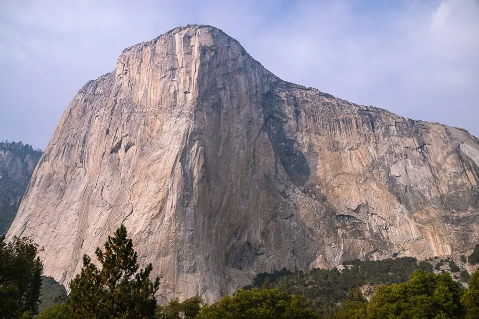
El Capitan is a granite rock formation and climbing area in the Sierra Nevada mountain range. At an elevation of 2,307 meters, it is one of the 120 sights listed for the United States on this site and is the 22nd most looked-up sight in the country on English Wikipedia.
Planning a visit
The warmest months are July and August, with daily highs of about 23 °C and 22 °C. The driest period is from June to September, when rainfall is at its lowest. In contrast, the winter months of December, January, and February are cold, with daily lows reaching -7 °C or -8 °C, and they also receive the most rain, with monthly totals exceeding 230 mm.
To reach El Capitan, you can fly into Mammoth Yosemite Airport, which is 71 km away, or Fresno Yosemite International Airport, located 107 km away. The site is 3,685 km from Washington, D.C. Visitors can combine a trip to this location with a visit to Yosemite National Park, which is 8.8 km away.
Weather by month
The warmest month is July, with an average high of 23 °C. The wettest is January, with about 269 mm of rain.
| Jan | Feb | Mar | Apr | May | Jun | Jul | Aug | Sep | Oct | Nov | Dec | |
|---|---|---|---|---|---|---|---|---|---|---|---|---|
| Average high, °C | 3 | 3 | 5 | 7 | 13 | 19 | 23 | 23 | 19 | 14 | 7 | 3 |
| Average low, °C | -7 | -7 | -6 | -4 | 0 | 5 | 9 | 8 | 5 | 1 | -5 | -8 |
| Rainfall, mm | 269 | 248 | 219 | 110 | 64 | 24 | 14 | 7 | 26 | 93 | 173 | 236 |
| Rainy days | 9 | 8 | 11 | 5 | 5 | 2 | 2 | 2 | 2 | 3 | 6 | 8 |
Temperatures and rainfall: 1981–2010 averages for this spot (4 km grid), from CHELSA. Rainy days: 2015–2024, NASA POWER.