Ozarks
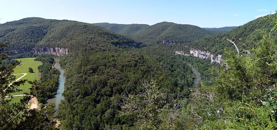
The Ozarks is a large area of igneous rock covering about 122,000 km². Part of the U.S. Interior Highlands, this region includes mountains, plateaus, and plains. It is the 23rd most looked-up sight in the United States on English Wikipedia.
Planning a visit
Visitors can choose between warmer and cooler months. July is the warmest month with a high of 31 °C, while January is the coldest with a high of 6 °C. Rainfall is highest in May, which sees about 144 mm of rain over 16 days. The driest periods occur in January, February, November, and December, when there are about 8 rainy days each month.
To reach the area, the nearest airport is Waynesville-St. Robert Regional Airport-Forney Field, located 70 km away. St. Louis Lambert International Airport is a larger hub 256 km from the region. The Ozarks is located about 1,367 km from Washington, D.C.
Weather by month
The warmest month is July, with an average high of 31 °C. Rain is spread fairly evenly through the year.
| Jan | Feb | Mar | Apr | May | Jun | Jul | Aug | Sep | Oct | Nov | Dec | |
|---|---|---|---|---|---|---|---|---|---|---|---|---|
| Average high, °C | 6 | 9 | 14 | 20 | 24 | 28 | 31 | 30 | 26 | 20 | 13 | 7 |
| Average low, °C | -3 | -1 | 4 | 9 | 14 | 19 | 21 | 20 | 16 | 10 | 4 | -1 |
| Rainfall, mm | 68 | 74 | 105 | 117 | 144 | 118 | 116 | 87 | 118 | 97 | 100 | 89 |
| Rainy days | 8 | 8 | 12 | 12 | 16 | 12 | 15 | 14 | 8 | 9 | 8 | 8 |
Temperatures and rainfall: 1981–2010 averages for this spot (4 km grid), from CHELSA. Rainy days: 2015–2024, NASA POWER.