Belize Barrier Reef Sistema de Reservas de la Barrera del Arrecife de Belice
Belize UNESCO World Heritage Site
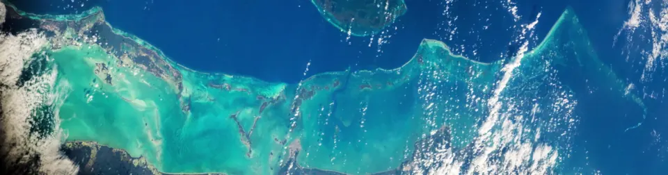
The Belize Barrier Reef is a cay and reef system located in Belize. As a designated World Heritage Site that forms part of the Mesoamerican Barrier Reef System, it covers an area of 963 square kilometers with a length of 300,000 meters. It ranks as the fifth most looked-up sight in the country on English Wikipedia.
Planning a visit
The climate features average temperatures ranging from 25 °C to 28 °C throughout the year. Precipitation varies significantly by month. April is the driest month with 41 mm of rain over about 6 days. October experiences the highest rainfall at 350 mm across about 24 days. June, July, August, September, and November also record high rainfall exceeding 200 mm per month.
To reach the reef, the nearest airport is Sir Barry Bowen Municipal Airport in Belize City, located 32 kilometers away, while Philip S. W. Goldson International Airport is 41 kilometers away. The site is 76 kilometers from the capital, Belmopan.
Weather by month
The warmest month is June, averaging 28 °C. The wettest is October, with about 350 mm of rain.
| Jan | Feb | Mar | Apr | May | Jun | Jul | Aug | Sep | Oct | Nov | Dec | |
|---|---|---|---|---|---|---|---|---|---|---|---|---|
| Average temperature, °C | 25 | 25 | 26 | 26 | 27 | 28 | 27 | 28 | 27 | 27 | 26 | 25 |
| Rainfall, mm | 181 | 86 | 57 | 41 | 123 | 256 | 221 | 234 | 270 | 350 | 280 | 188 |
| Rainy days | 16 | 11 | 9 | 6 | 13 | 22 | 24 | 23 | 24 | 24 | 20 | 20 |
Temperatures and rainfall: 1981–2010 averages for this spot (4 km grid), from CHELSA. Rainy days: 2015–2024, NASA POWER.