Colombia
Country · Americas, South America

Colombia is a country located in South America with a population of about 53 million in 2025 and an area of 1,141,748 square kilometers. Its capital is Bogotá. The country offers a traveller 10 top sights.
Highlights
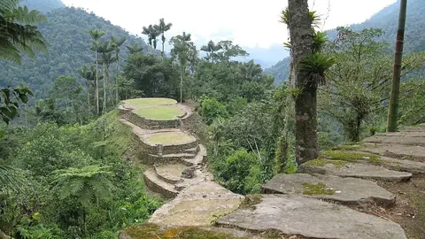
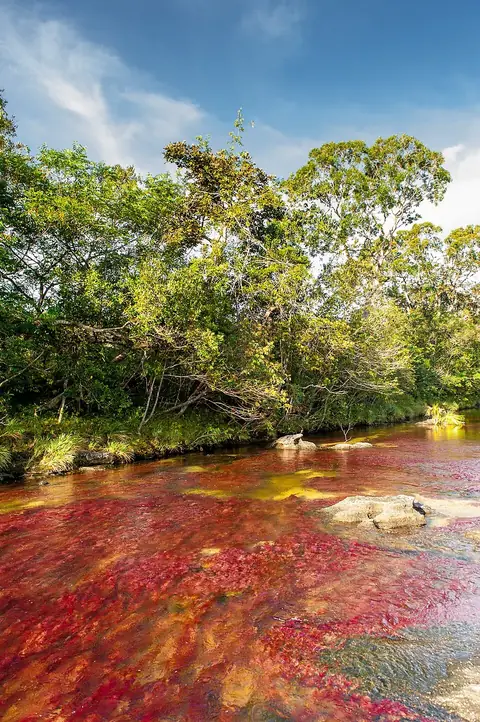
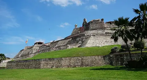
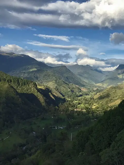
The site covers 10 top sights across the country. Notable sights include Nevado del Ruiz, Ciudad Perdida, Caño Cristales, Salt Cathedral of Zipaquirá, Monserrate, Castillo San Felipe de Barajas, Casa de Nariño, Gold Museum, Bogotá, Cocora Valley, and San Agustín Archaeological Park (UNESCO). The listed city is Bogotá.
Food and drink
Local dishes include Arepa, Ajiaco, Oblea, Ropa vieja, Changua, Bocadillo, Almojábana, Pandebono, Polvorosas, and Cuchuco.
When to go
The climate data reflects the capital Bogotá based on daily highs and lows. January and February have highs of 19 °C and lows of 10 °C, with rain between 43 mm and 56 mm. March brings highs of 19 °C and lows of 11 °C with 81 mm of rain. April and May see highs of 18 °C and lows of 11 °C, with rainfall of 112 mm and 105 mm. June and July record highs of 18 °C and lows of 10 °C, with 61 mm and 54 mm of rain. August has highs of 19 °C and lows of 10 °C with 46 mm of rain. September features highs of 20 °C and lows of 10 °C with 56 mm of rain. October shows highs of 19 °C and lows of 10 °C with 112 mm of rain. November reaches highs of 18 °C and lows of 10 °C with 118 mm of rain. December records highs of 18 °C and lows of 10 °C with 62 mm of rain.
Practical notes
The currency is the Colombian peso. The official language is Spanish. Plugs are type A and B with a voltage of 110.0 V. Driving is on the right side. The time zone is UTC−05:00.
Cities
Food and drink to try in Colombia
- Arepa
- Ajiaco
- Oblea
- Ropa vieja
- Changua
- Bocadillo
- Almojábana
- Pandebono
- Polvorosas
- Cuchuco
Top sights in Colombia






Weather by month
Temperatures stay much the same all year, around 14 °C on average. The wettest is November, with about 118 mm of rain.
| Jan | Feb | Mar | Apr | May | Jun | Jul | Aug | Sep | Oct | Nov | Dec | |
|---|---|---|---|---|---|---|---|---|---|---|---|---|
| Average high, °C | 19 | 19 | 19 | 18 | 18 | 18 | 18 | 19 | 20 | 19 | 18 | 19 |
| Average low, °C | 10 | 10 | 11 | 11 | 11 | 11 | 10 | 10 | 10 | 10 | 10 | 10 |
| Rainfall, mm | 43 | 56 | 81 | 112 | 105 | 61 | 54 | 46 | 56 | 112 | 118 | 62 |
| Rainy days | 14 | 15 | 24 | 25 | 25 | 25 | 24 | 20 | 20 | 25 | 24 | 17 |
Temperatures and rainfall: 1981–2010 averages for Bogotá (4 km grid), from CHELSA. Rainy days: 2015–2024, NASA POWER.
Also worth a look
- Amacayacu National Park
- Chingaza National Natural Park
- Chiribiquete National Park
- El Gato del Río
- Los Katíos National Park
- Los Nevados National Natural Park
- Morro del Tulcán
- Mosque of Omar Ibn Al-Khattab
- Museo Botero
- National Museum of Colombia
- Nevado del Huila
- Puerta del Reloj
- Salitre Mágico
- Sierra Nevada del Cocuy
- Tayrona National Natural Park
- Tierradentro
- Usaquén