Chimborazo
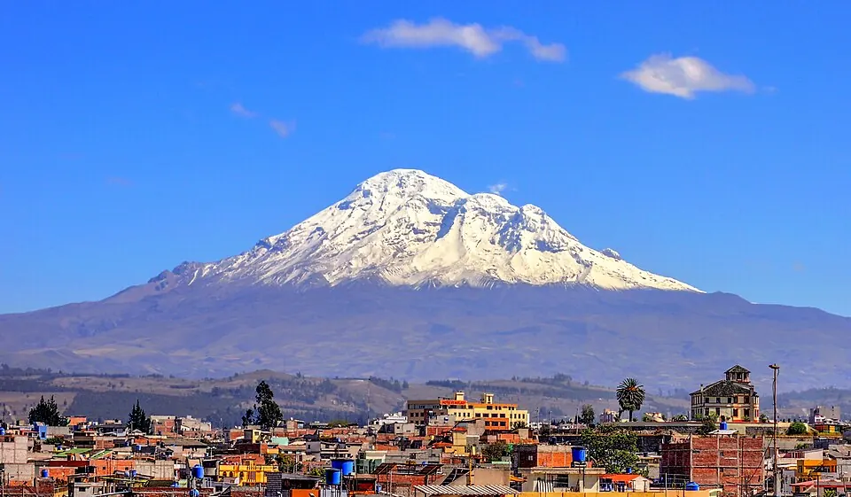
Chimborazo is a stratovolcano and mountain located in the Andes of Chimborazo Province, Ecuador. It is one of the most looked-up sights in Ecuador, ranking first among the country's sights on English Wikipedia.
Planning a visit
The climate features daily highs and lows throughout the year, with temperatures ranging from lows of -6 °C in July and August to highs of 5 °C in most months. Rainfall varies significantly, with August experiencing the least rain at 63 mm over about 15 days, while March sees the highest rainfall at 232 mm over about 27 days.
To reach Chimborazo, the nearest airport is Cotopaxi International Airport in Latacunga, located 66 km away, while José Joaquín de Olmedo International Airport in Guayaquil is 141 km away. The location is 143 km from the capital, Quito.
Weather by month
The warmest month is September, with an average high of 5 °C. The wettest is March, with about 232 mm of rain.
| Jan | Feb | Mar | Apr | May | Jun | Jul | Aug | Sep | Oct | Nov | Dec | |
|---|---|---|---|---|---|---|---|---|---|---|---|---|
| Average high, °C | 5 | 5 | 5 | 5 | 5 | 4 | 3 | 4 | 5 | 5 | 5 | 5 |
| Average low, °C | -4 | -4 | -3 | -3 | -4 | -5 | -6 | -6 | -5 | -4 | -4 | -4 |
| Rainfall, mm | 124 | 180 | 232 | 219 | 141 | 96 | 68 | 63 | 76 | 98 | 111 | 122 |
| Rainy days | 26 | 26 | 27 | 28 | 26 | 24 | 20 | 15 | 15 | 21 | 22 | 25 |
Temperatures and rainfall: 1981–2010 averages for this spot (4 km grid), from CHELSA. Rainy days: 2015–2024, NASA POWER.