Ambohimanga
Madagascar UNESCO World Heritage Site
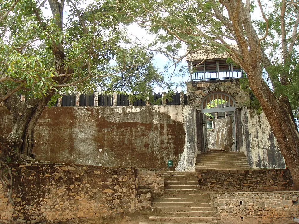
Ambohimanga is a significant human settlement and archaeological site situated on a hill in the Antananarivo Province of Madagascar. Recognized as a World Heritage Site, this location is the second most looked-up sight in the country on English Wikipedia. It offers insight into the history of the region through its preserved structures and elevated position at 1,468 meters.
Planning a visit
The climate at Ambohimanga is characterized by distinct wet and dry seasons. The driest months are June, July, August, and September, which see between 8 mm and 14 mm of rain, making these the most suitable times for outdoor exploration. Temperatures during these months are cooler, with daily highs ranging from 18 °C to 22 °C and lows around 10 °C to 11 °C. The rainy season, extending from November through March, experiences significantly higher precipitation, often exceeding 200 mm per month.
Ambohimanga is located 17 km from the capital city of Antananarivo. The nearest airport is Ivato International Airport, which is 10 km away. Visitors can combine a trip to this site with other nearby attractions in the Antananarivo Province. The site covers an area of 0.59 km2.
Weather by month
The warmest month is November, with an average high of 25 °C. The wettest is January, with about 388 mm of rain.
| Jan | Feb | Mar | Apr | May | Jun | Jul | Aug | Sep | Oct | Nov | Dec | |
|---|---|---|---|---|---|---|---|---|---|---|---|---|
| Average high, °C | 25 | 24 | 24 | 23 | 21 | 19 | 18 | 19 | 22 | 24 | 25 | 25 |
| Average low, °C | 16 | 16 | 16 | 15 | 13 | 11 | 10 | 10 | 11 | 13 | 14 | 16 |
| Rainfall, mm | 388 | 304 | 222 | 56 | 26 | 8 | 10 | 12 | 14 | 63 | 148 | 306 |
| Rainy days | 30 | 26 | 28 | 24 | 23 | 20 | 21 | 17 | 12 | 15 | 23 | 27 |
Temperatures and rainfall: 1981–2010 averages for this spot (4 km grid), from CHELSA. Rainy days: 2015–2024, NASA POWER.